Skip Navigation Links
NOAA NOAA United States Department of Commerce

NHC Graphical Outlook Archive


« Earliest Available         ‹ Earlier         Later ›         Latest Available »
GIS Shapefiles
Central Pacific Eastern North Pacific Atlantic

View 2-Day Graphical Tropical Weather Outlook
Click for Eastern North Pacific Click for Eastern North Pacific

Tropical Weather Outlook Text

ZCZC MIATWOAT ALL
TTAA00 KNHC DDHHMM

Tropical Weather Outlook
NWS National Hurricane Center Miami FL
200 AM EDT Sun Jul 21 2019

For the North Atlantic...Caribbean Sea and the Gulf of Mexico:

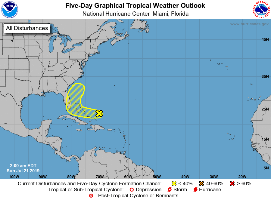
1. A tropical wave located about 300 miles east of the Central Bahamas
is producing disorganized showers and a few thunderstorms. Although
environmental conditions are currently unfavorable for development,
they are expected to become a little more conducive over the next
few days while the disturbance moves westward at 10 to 15 mph.
Interests in the Central and Northwest Bahamas, and the southern
Florida peninsula and the Florida Keys should monitor the progress
of this system.
* Formation chance through 48 hours...low...10 percent.
* Formation chance through 5 days...low...20 percent.

Forecaster Stewart


List of Atlantic Outlooks (May 2023 - present)
List of East Pacific Outlooks (May 2023 - present)
List of Central Pacific Outlooks (May 2023 - present)
List of Atlantic Outlooks (July 2014 - April 2023)
List of East Pacific Outlooks (July 2014 - April 2023)
List of Central Pacific Outlooks (June 2019 - April 2023)
List of Atlantic Outlooks (June 2009 - June 2014)
List of East Pacific Outlooks (June 2009 - June 2014)