ZCZC MIATWOAT ALL
TTAA00 KNHC DDHHMM
Tropical Weather Outlook
NWS National Hurricane Center Miami FL
800 AM EDT Sat Sep 1 2018
For the North Atlantic...Caribbean Sea and the Gulf of Mexico:
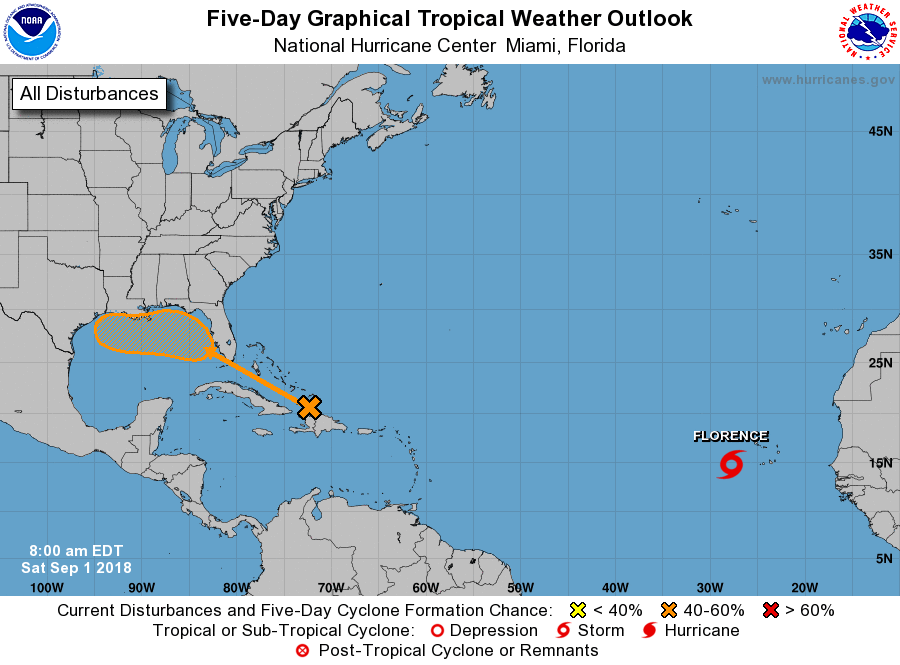
The National Hurricane Center is issuing advisories on recently
upgraded Tropical Storm Florence, located about a couple of hundred
miles west of the Cabo Verde Islands.
1. A tropical wave interacting with an upper-level trough is producing
numerous showers and thunderstorms from Hispaniola northward across
the Turks and Caicos Islands. This activity is forecast to spread
west-northwestward, enhancing rainfall across Hispaniola, the Turks
and Caicos Islands, the Bahamas this weekend, and across Florida
and the northern Gulf of Mexico coast by early next week. Strong
upper-level winds will likely prevent significant development of
this system during the next couple of days, but environmental
conditions are expected to become a little more favorable for a
surface low pressure area to form when the disturbance moves across
the Gulf of Mexico during the early to middle part of next week.
* Formation chance through 48 hours...low...10 percent.
* Formation chance through 5 days...medium...40 percent.
Forecaster Avila