ZCZC MIATWOAT ALL
TTAA00 KNHC DDHHMM
Tropical Weather Outlook
NWS National Hurricane Center Miami FL
200 AM EDT Sat Sep 1 2018
For the North Atlantic...Caribbean Sea and the Gulf of Mexico:
The National Hurricane Center is issuing advisories on Tropical
Depression Six, located about a hundred miles west-southwest of the
Cabo Verde Islands.
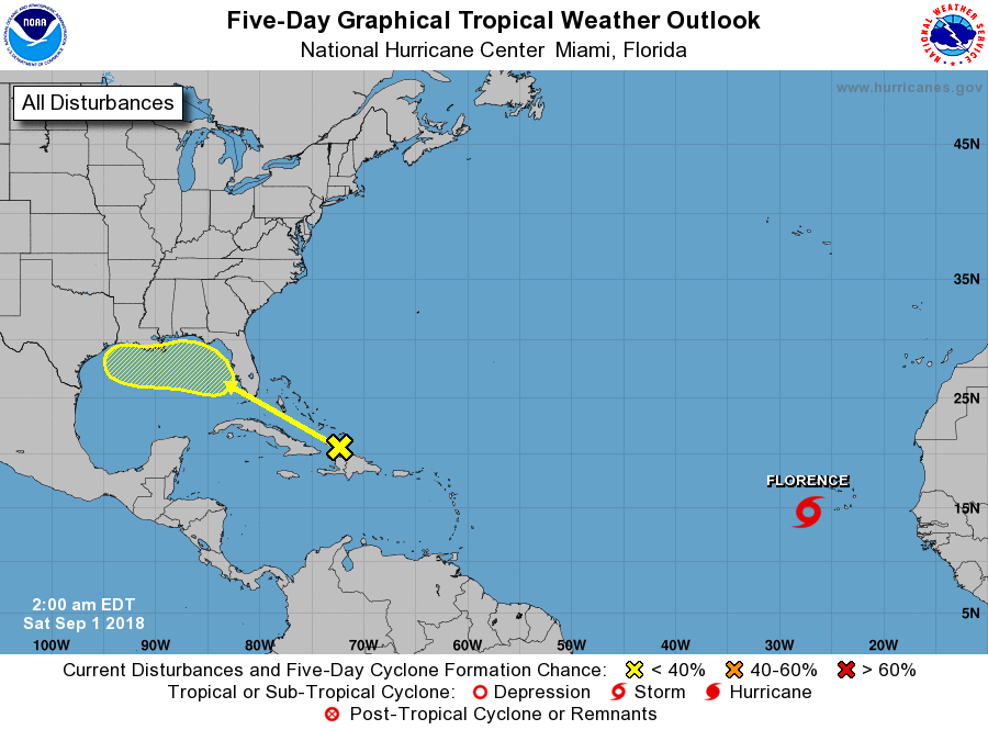
1. A tropical wave interacting with an upper-level trough is producing
disorganized showers and thunderstorms from Hispaniola northward
across the Turks and Caicos Islands. This activity is forecast to
spread west-northwestward, enhancing rainfall across portions of
Hispaniola, the Turks and Caicos Islands, the Bahamas, Florida, and
the northern Gulf of Mexico coast through the middle of next week.
Strong upper-level winds are expected to prevent development of this
system during the next couple of days, but environmental conditions
could become less hostile when the system moves across the northern
Gulf of Mexico during the early to middle part of next week.
* Formation chance through 48 hours...low...near 0 percent.
* Formation chance through 5 days...low...20 percent.
Forecaster Berg