ZCZC MIATWOAT ALL
TTAA00 KNHC DDHHMM
Special Tropical Weather Outlook
NWS National Hurricane Center Miami FL
1040 PM EDT Tue Aug 14 2018
For the North Atlantic...Caribbean Sea and the Gulf of Mexico:
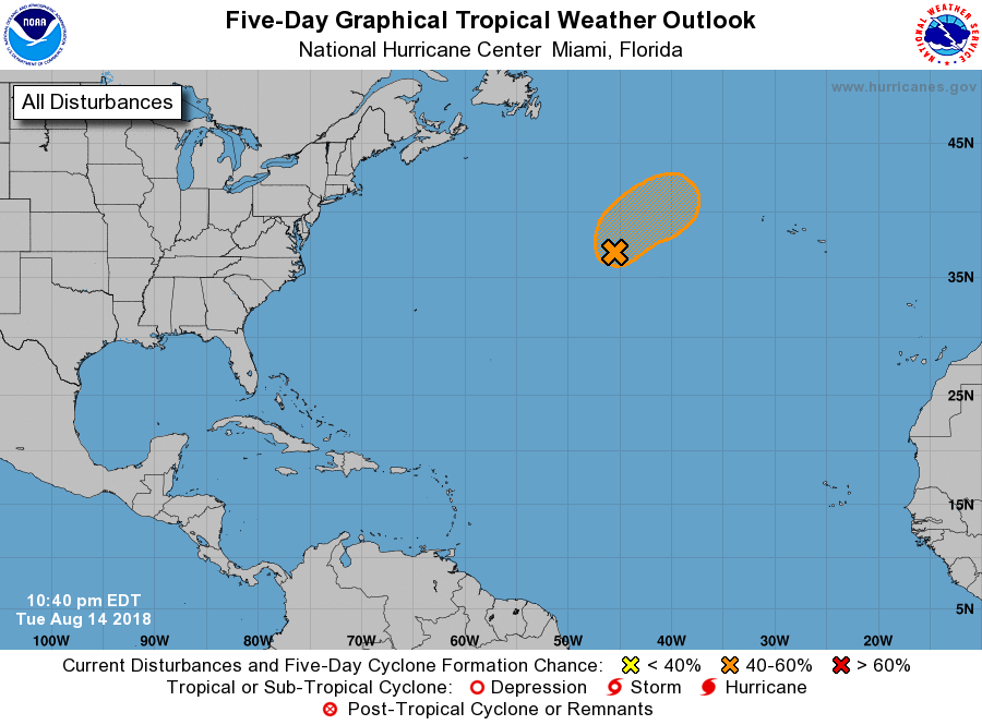
Special outlook issued to update discussion of the area of low
pressure located well southeast of Cape Race, Newfoundland.
1. Updated: Satellite imagery indicates that shower and thunderstorm
activity associated with the area of low pressure located about 800
miles south-southeast of Cape Race, Newfoundland, has become better
organized during the past few hours. Satellite-derived wind data
also indicate that the surface circulation has become better defined
since earlier today. Conditions appear conducive for some additional
development during the next day or so, and a subtropical depression
or subtropical storm could form overnight or on Wednesday while the
low moves northward to northeastward. Later this week, the low is
expected to move northeastward over colder waters and merge with a
frontal zone over the northern Atlantic.
* Formation chance through 48 hours...medium...60 percent.
* Formation chance through 5 days...medium...60 percent.
Forecaster Brennan/Stewart