ZCZC MIATWOAT ALL
TTAA00 KNHC DDHHMM
Tropical Weather Outlook
NWS National Hurricane Center Miami FL
800 AM EDT Sat Aug 12 2017
For the North Atlantic...Caribbean Sea and the Gulf of Mexico:
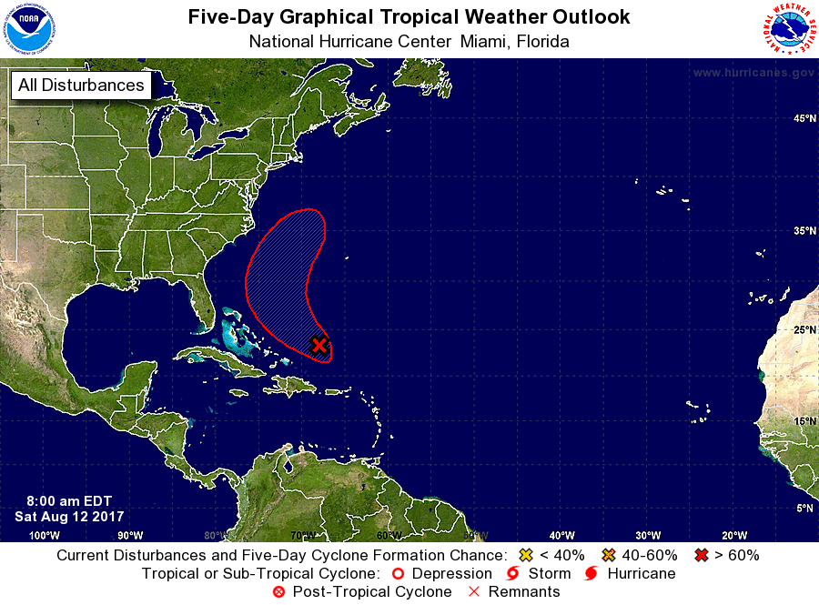
1. A low pressure area located about 150 miles northeast of the Turks
and Caicos Islands has become a little better defined this morning
and the shower activity has increased somewhat since yesterday.
Conditions are gradually becoming more conducive for development,
and a tropical depression could form during the next day or two. The
low is forecast to move northwestward and then northward through the
weekend, and then turn to the northeast away from the United States
early next week.
* Formation chance through 48 hours...medium...60 percent.
* Formation chance through 5 days...high...70 percent.
Forecaster Avila