Skip Navigation Links
NOAA NOAA United States Department of Commerce

NHC Graphical Outlook Archive


« Earliest Available         ‹ Earlier         Later ›         Latest Available »
GIS Shapefiles
tab Eastern North Pacific tab tab Atlantic tab

View 2-Day Graphical Tropical Weather Outlook
Click for Eastern North Pacific Click for Eastern North Pacific

Tropical Weather Outlook Text

ZCZC MIATWOAT ALL
TTAA00 KNHC DDHHMM

Tropical Weather Outlook
NWS National Hurricane Center Miami FL
800 AM EDT Tue Jul 4 2017

For the North Atlantic...Caribbean Sea and the Gulf of Mexico:

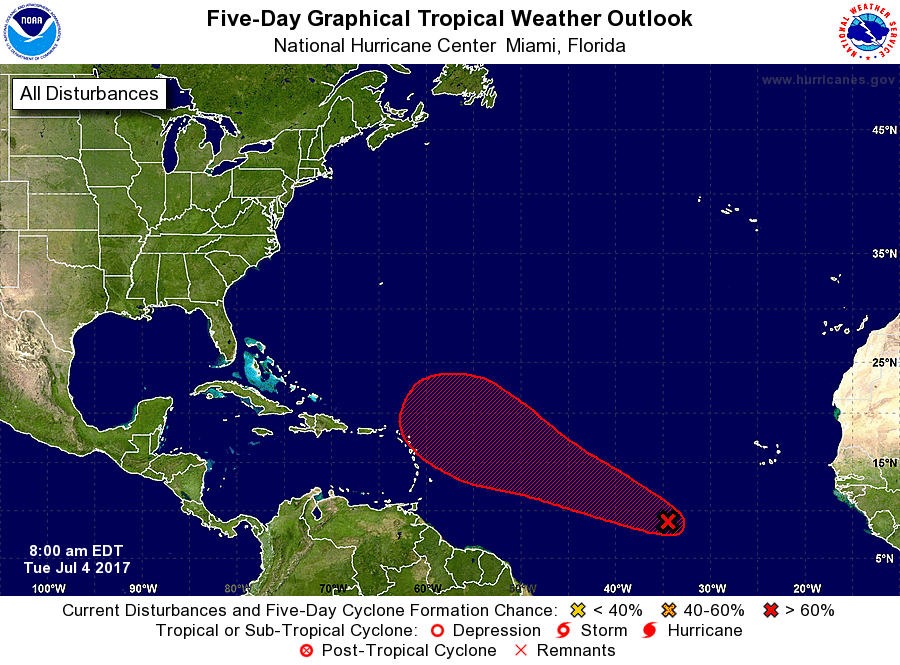
1. Early morning satellite images indicate that the cloud pattern
associated with the low pressure system located about 800 miles
west-southwest of the Cabo Verde Islands has not changed very
much in organization. Environmental conditions, however, are
favorable for a tropical depression or a tropical storm to form
within the next 24 hours or so while the low moves westward or
west-northwestward at 10 to 15 mph across the tropical Atlantic.
* Formation chance through 48 hours...high...70 percent.
* Formation chance through 5 days...high...80 percent.

Forecaster Avila


List of Atlantic Outlooks (May 2023 - present)
List of East Pacific Outlooks (May 2023 - present)
List of Central Pacific Outlooks (May 2023 - present)
List of Atlantic Outlooks (July 2014 - April 2023)
List of East Pacific Outlooks (July 2014 - April 2023)
List of Central Pacific Outlooks (June 2019 - April 2023)
List of Atlantic Outlooks (June 2009 - June 2014)
List of East Pacific Outlooks (June 2009 - June 2014)