ZCZC MIATWOAT ALL
TTAA00 KNHC DDHHMM
TROPICAL WEATHER OUTLOOK
NWS NATIONAL HURRICANE CENTER MIAMI FL
ISSUED BY THE NWS WEATHER PREDICTION CENTER COLLEGE PARK MD
200 PM EDT TUE OCT 4 2016
For the North Atlantic...Caribbean Sea and the Gulf of Mexico:
The National Hurricane Center is issuing advisories on Hurricane
Matthew, located near southwestern Haiti, and on newly formed
Tropical Storm Nicole located near the central tropical Atlantic.
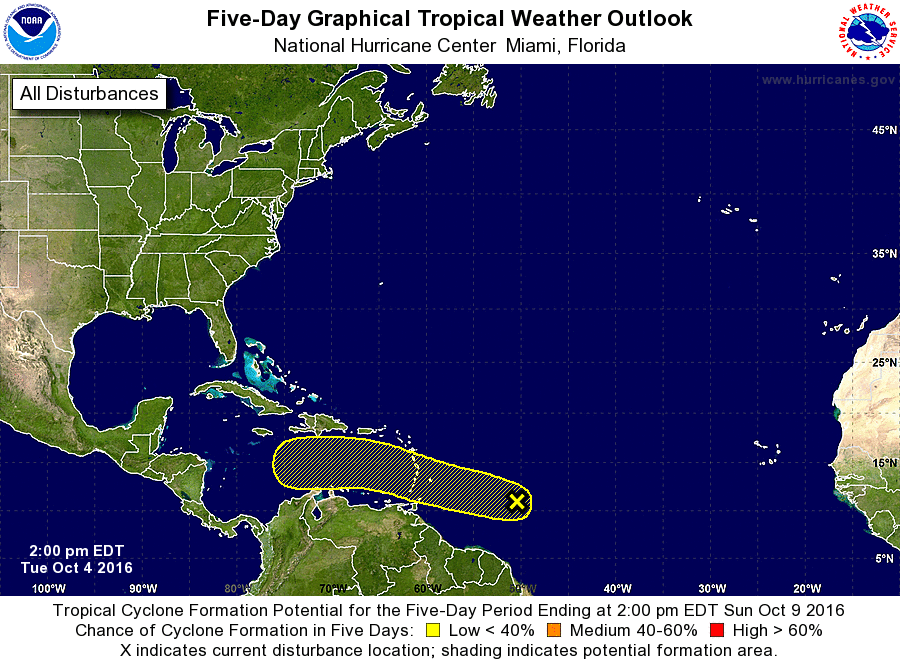
1. A tropical wave located several hundred miles east of the Windward
Islands is producing a large area of disorganized showers and
thunderstorms. Development, if any, of this system is expected to be
slow to occur while the wave moves westward at 10 to 15 mph.
Regardless of development, heavy rain and gusty winds are
possible in the Windward Islands during the next couple of days
during the wave's passage.
* Formation chance through 48 hours...low...10 percent
* Formation chance through 5 days...low...20 percent
Public Advisories on Tropical Storm Nicole are issued under WMO
header WTNT35 KNHC and under AWIPS header MIATCPAT5.
Forecast/Advisories on Tropical Storm Nicole are issued under WMO
header WTNT25 KNHC and under AWIPS header MIATCMAT5.
Forecaster Hurley/Blake