ZCZC MIATWOAT ALL
TTAA00 KNHC DDHHMM
TROPICAL WEATHER OUTLOOK
NWS NATIONAL HURRICANE CENTER MIAMI FL
800 AM EDT TUE OCT 4 2016
For the North Atlantic...Caribbean Sea and the Gulf of Mexico:
The National Hurricane Center is issuing advisories on Hurricane
Matthew, located near southwestern Haiti.
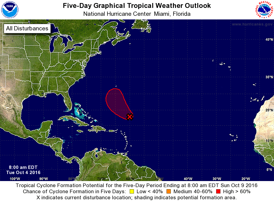
1. Showers and thunderstorms continue in association with a low
pressure area located about 500 miles northeast of Puerto Rico.
Satellite wind data indicate that the low is producing winds to
gale force, and the system could become sufficiently well organized
to result in the formation of a tropical storm later today. The
low is expected to move generally northwestward at 10 to 15 mph over
the next few days, and upper-level winds are forecast to become
less conducive for development.
* Formation chance through 48 hours...high...80 percent
* Formation chance through 5 days...high...80 percent
Forecaster Pasch