ZCZC MIATWOAT ALL
TTAA00 KNHC DDHHMM
TROPICAL WEATHER OUTLOOK
NWS NATIONAL HURRICANE CENTER MIAMI FL
200 AM EDT TUE OCT 4 2016
For the North Atlantic...Caribbean Sea and the Gulf of Mexico:
The National Hurricane Center is issuing advisories on Hurricane
Matthew, located over the central Caribbean Sea near southwestern
Haiti.
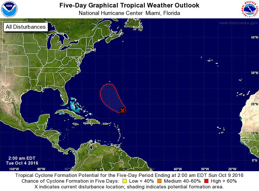
1. Showers and thunderstorms continue in association with a low
pressure area located about 400 miles north-northeast of the
northern Leeward Islands. Recent satellite data indicate that the
circulation is elongated and the low does not have a well-defined
center. However, only a slight increase in organization of this
system would result in the formation of a tropical depression during
the next day or two before upper-level winds become unfavorable for
development. This system is expected to move generally
northwestward at 10 to 15 mph during the next few days.
* Formation chance through 48 hours...high...70 percent
* Formation chance through 5 days...high...70 percent
Forecaster Cangialosi