ZCZC MIATWOAT ALL
TTAA00 KNHC DDHHMM
TROPICAL WEATHER OUTLOOK
NWS NATIONAL HURRICANE CENTER MIAMI FL
200 PM EDT SAT SEP 17 2016
For the North Atlantic...Caribbean Sea and the Gulf of Mexico:
The National Hurricane Center is issuing advisories on Tropical
Depression Julia, located a few hundred miles southeast of the
coast of South Carolina, and on Tropical Storm Karl, located about
midway between Africa and the Leeward Islands.
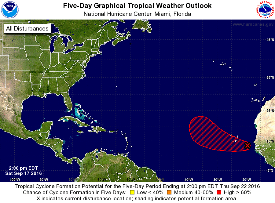
1. Showers and thunderstorms continue near an elongated area of low
pressure located between Africa and the Cabo Verde Islands.
Environmental conditions appear conducive for development, and a
tropical depression could form by the early part of next week while
this system moves west-northwestward to northwestward across the
eastern tropical Atlantic. This system is likely to bring heavy
rain and gusty winds to portions of the Cabo Verde Islands during
the next couple of days.
* Formation chance through 48 hours...medium...40 percent
* Formation chance through 5 days...high...70 percent
Forecaster Blake