ZCZC MIATWOEP ALL
TTAA00 KNHC DDHHMM
TROPICAL WEATHER OUTLOOK
NWS NATIONAL HURRICANE CENTER MIAMI FL
1100 AM PDT SAT SEP 17 2016
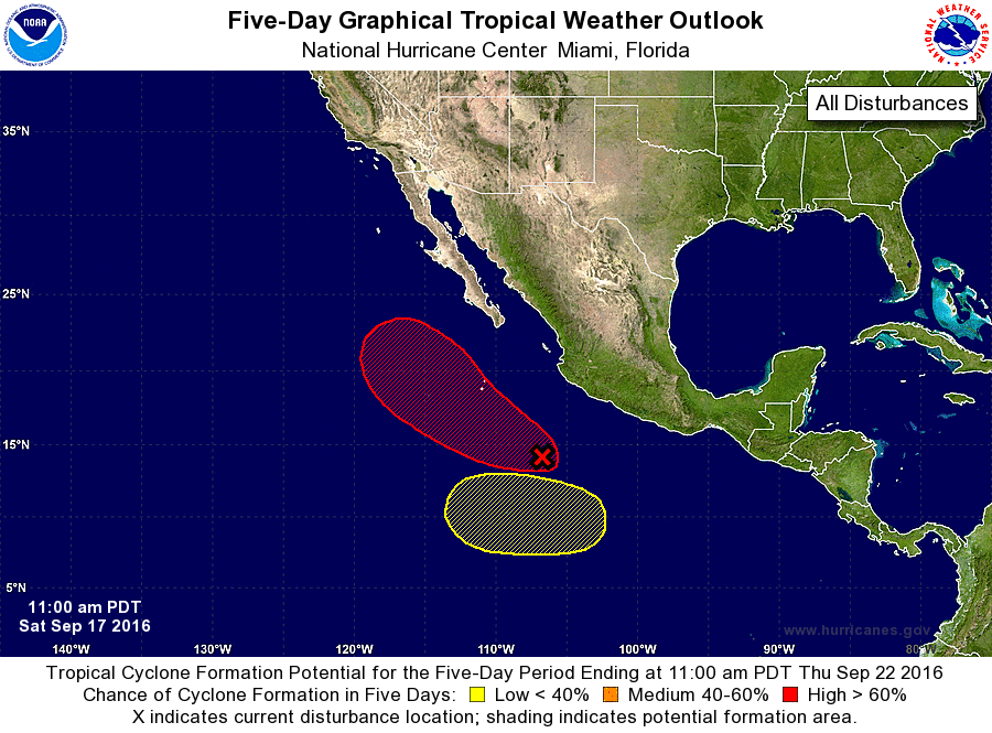
For the eastern North Pacific...east of 140 degrees west longitude:
1. Satellite imagery indicates that shower activity associated with
the low pressure area located about 375 miles south-southwest of
Manzanillo, Mexico is becoming better organized and that the
circulation is becoming better defined. If current trends
continue, a tropical depression could form later this afternoon or
tonight while this system moves west-northwestward at 10 to 15 mph a
few hundred miles offshore of the coast of Mexico.
* Formation chance through 48 hours...high...90 percent
* Formation chance through 5 days...high...90 percent
2. An area of low pressure could form early next week several hundred
miles southwest of southern Mexico. Some gradual development is
possible by midweek while the system moves slowly westward.
* Formation chance through 48 hours...low...near 0 percent
* Formation chance through 5 days...low...20 percent
Forecaster Beven