ZCZC MIATWOAT ALL
TTAA00 KNHC DDHHMM
TROPICAL WEATHER OUTLOOK
NWS NATIONAL HURRICANE CENTER MIAMI FL
800 PM EDT MON SEP 12 2016
For the North Atlantic...Caribbean Sea and the Gulf of Mexico:
The National Hurricane Center is issuing advisories on Tropical
Storm Ian, located well to the east-southeast of Bermuda.
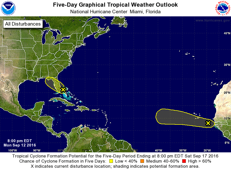
1. An area of disturbed weather is moving through the northwestern
Bahamas at 5 to 10 mph. Although some increase in the amount and
organization of associated thunderstorm activity could occur tonight
when the system moves over the warmer waters of the Gulf Stream,
strong upper-level winds and proximity to land are expected to
prevent the development of a tropical cyclone before the disturbance
moves inland over southeastern Florida Tuesday morning. However,
locally heavy rainfall and gusty winds are possible over portions of
the northwestern Bahamas tonight, and over portions of the central
and southern Florida peninsula on Tuesday.
* Formation chance through 48 hours...low...10 percent
* Formation chance through 5 days...low...10 percent
2. A tropical wave, accompanied by a broad area of low pressure, is
located a few hundred miles southeast of the Cabo Verde Islands.
This system is producing a large area of cloudiness and disorganized
shower activity. Slow development of this disturbance is possible
during the next several days while the system moves west-
northwestward to westward at 10 to 15 mph over the tropical
Atlantic.
* Formation chance through 48 hours...low...10 percent
* Formation chance through 5 days...low...20 percent
Public Advisories on Tropical Storm Ian are issued under WMO header
WTNT35 KNHC and under AWIPS header MIATCPAT5.
Forecast/Advisories on Tropical Storm Ian are issued under WMO
header WTNT25 KNHC and under AWIPS header MIATCMAT5.
Forecaster Stewart