


NHC Graphical Outlook Archive
|
« Earliest Available ‹ Earlier Later › Latest Available » |
GIS Shapefiles |
| Eastern North Pacific | Atlantic |
|
Tropical Weather Outlook Text
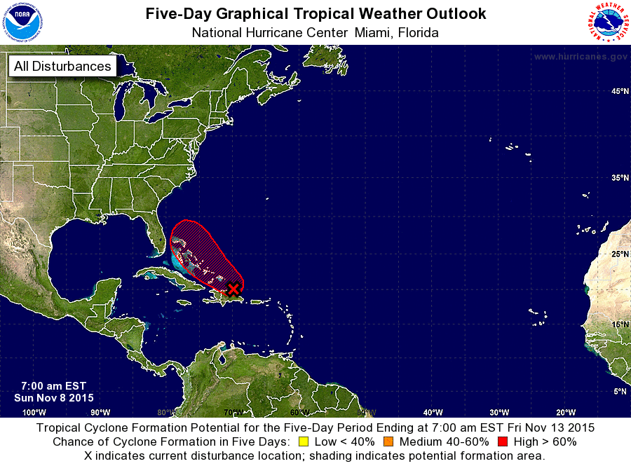
ZCZC MIATWOAT ALL
TTAA00 KNHC DDHHMM

TROPICAL WEATHER OUTLOOK
NWS NATIONAL HURRICANE CENTER MIAMI FL
700 AM EST SUN NOV 8 2015

For the North Atlantic...Caribbean Sea and the Gulf of Mexico:

1. Showers and thunderstorms have become more concentrated overnight in
association with a low pressure area located about 100 miles
southeast of the Turks and Caicos.  Surface observations indicate
that gale-force winds have been occurring in brief squalls mainly to
the east of the center.  Environmental conditions are expected to be
conducive for gradual development of this system, and a tropical
depression could form during the next couple of days while it moves
west-northwestward over the Bahamas and then turns northwestward.
Locally heavy rains and strong gusty winds are possible over
Hispaniola today, and over the Turks and Caicos and the southeastern
Bahamas during the next day or so.
* Formation chance through 48 hours...medium...50 percent
* Formation chance through 5 days...high...70 percent

Forecaster Cangialosi/Stewart
List of Atlantic Outlooks (May 2023 - present)
List of East Pacific Outlooks (May 2023 - present)
List of Central Pacific Outlooks (May 2023 - present)
List of Atlantic Outlooks (July 2014 - April 2023)
List of East Pacific Outlooks (July 2014 - April 2023)
List of Central Pacific Outlooks (June 2019 - April 2023)
List of Atlantic Outlooks (June 2009 - June 2014)
List of East Pacific Outlooks (June 2009 - June 2014)