ZCZC HFOTWOCP ALL
TTAA00 PHFO DDHHMM
Tropical Weather Outlook
NWS Central Pacific Hurricane Center Honolulu HI
200 AM HST Tue Sep 12 2023
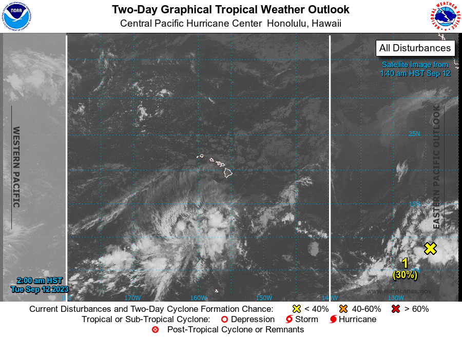
For the central North Pacific...between 140W and 180W:
1. Western East Pacific:
A broad area of disorganized showers and thunderstorms associated
with a tropical wave is located well southwest of the southern tip
of the Baja California peninsula. Some slow development of this
system is expected during the next few days, and a tropical
depression could form while it moves generally west-northwestward
across the western portion of the eastern Pacific basin. This
system may move into the Central Pacific basin this weekend.
* Formation chance through 48 hours...low...30 percent.
* Formation chance through 7 days...medium...50 percent.
Elsewhere, no tropical cyclones are expected during the next 7 days.
Forecaster Blood