ZCZC MIATWOEP ALL
TTAA00 KNHC DDHHMM

Tropical Weather Outlook
NWS National Hurricane Center Miami FL
500 PM PDT Sat Sep 2 2023

For the eastern North Pacific...east of 140 degrees west longitude:

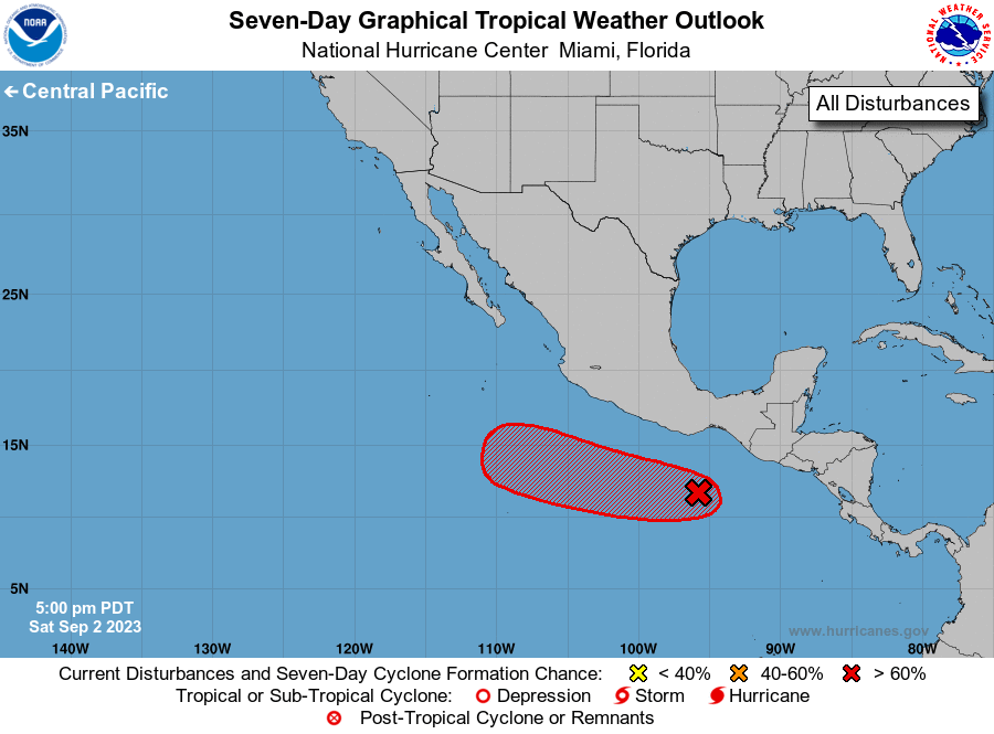
1. Central East Pacific:
A tropical wave is producing disorganized showers and thunderstorms
a couple of hundred miles south of the coast of southern Mexico.
Environmental conditions are forecast to be conducive for gradual
development of this system, and a tropical depression is expected
to form by the middle of next week.  The system is forecast to move
westward to west-northwestward, passing well south of mainland
Mexico.
* Formation chance through 48 hours...low...30 percent.
* Formation chance through 7 days...high...90 percent.

Forecaster Cangialosi





 NHC on Facebook
 Twitter
 YouTube
 NHC Blog: