ZCZC HFOTWOCP ALL
TTAA00 PHFO DDHHMM

Tropical Weather Outlook
NWS Central Pacific Hurricane Center Honolulu HI
200 PM HST Fri Sep 1 2023

For the central North Pacific...between 140W and 180W:

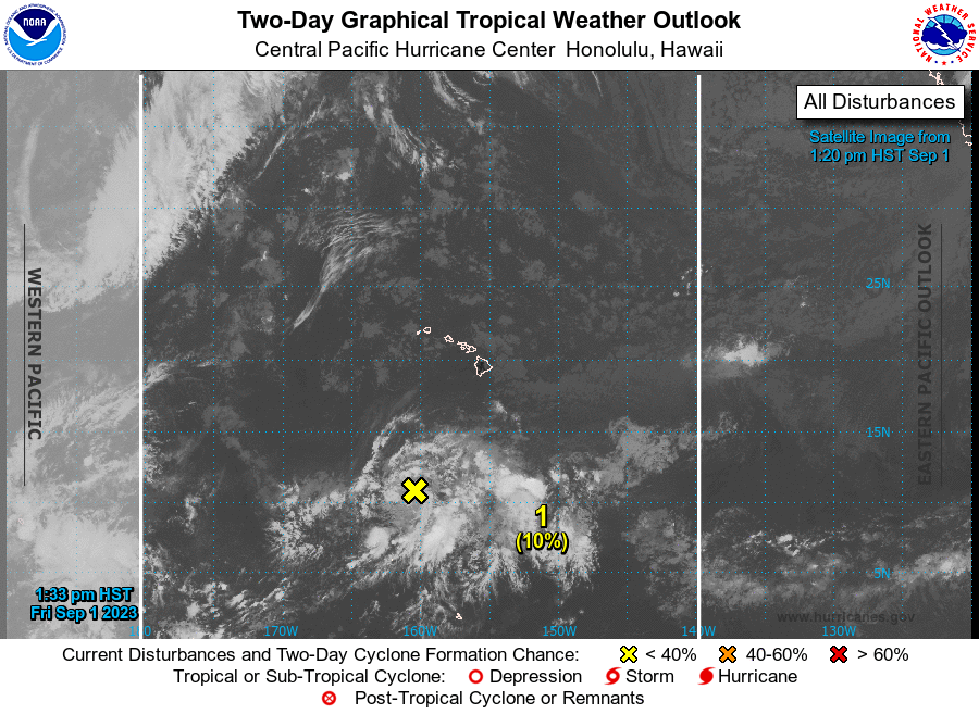
1. Approximately 750 miles south of Honolulu, Hawaii:
A weak area of low pressure located far south of Honolulu, Hawaii
is producing disorganized showers and thunderstorms.
As this area moves northwestward, there is a short window for
possible development over the next day or so before upper level
conditions become unfavorable.
* Formation chance through 48 hours...low...10 percent.
* Formation chance through 7 days...low...10 percent.

Forecaster Kodama





 NHC on Facebook
 Twitter
 YouTube
 NHC Blog: