ZCZC MIATWOEP ALL
TTAA00 KNHC DDHHMM
Tropical Weather Outlook
NWS National Hurricane Center Miami FL
500 AM PDT Fri Aug 25 2023
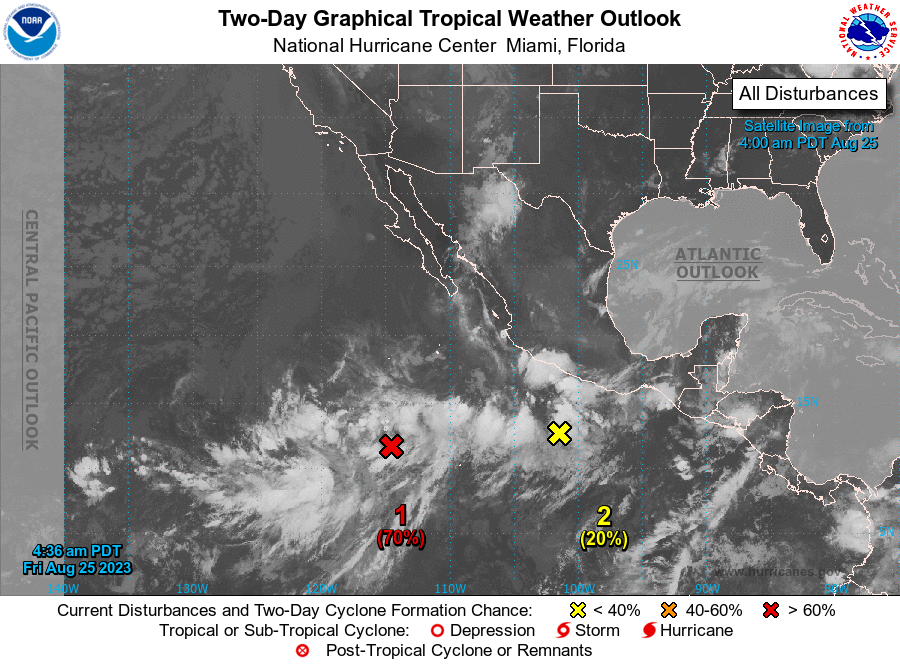
For the eastern North Pacific...east of 140 degrees west longitude:
1. Central East Pacific (EP92):
Showers and thunderstorms are gradually becoming better organized in
association with a low pressure system located well south-southwest
of the southern tip of the Baja California Peninsula. Environmental
conditions are expected to become more favorable for additional
development of this system during the next day or so. A tropical
depression is likely to form during the next couple of days while it
moves west-northwestward at 10 to 15 mph over the central portion of
the tropical eastern Pacific.
* Formation chance through 48 hours...high...70 percent.
* Formation chance through 7 days...high...80 percent.
2. South of Southwestern Mexico (EP91):
A trough of low pressure located a few hundred miles south of the
southern and southwestern coast of Mexico is producing disorganized
shower and thunderstorm activity. Environmental conditions appear
marginally conducive for some slow development of this system, and a
tropical depression could form during the next few days while it
moves slowly northwestward or northward toward southwestern Mexico.
Interests in southwestern Mexico should monitor the progress of this
system.
* Formation chance through 48 hours...low...20 percent.
* Formation chance through 7 days...medium...40 percent.
Forecaster Kelly/Blake