ZCZC MIATWOEP ALL
TTAA00 KNHC DDHHMM

Tropical Weather Outlook
NWS National Hurricane Center Miami FL
500 AM PDT Tue Jul 11 2023

For the eastern North Pacific...east of 140 degrees west longitude:

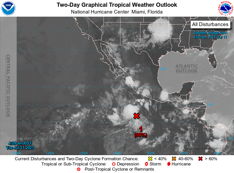
1. Offshore of Southern Mexico (EP94):
Shower and thunderstorm activity continues to become better
organized in association with an area of low pressure located a few
hundred miles south of the southern coast of Mexico. The system
does not yet have a well-defined center, but is producing winds
near tropical-storm-force on its west side. Any additional
organization of the low-level center, will lead to a tropical storm
developing later today or tonight. The system is expected to move
westward to west-northwestward at 15 to 20 mph over the next several
days, remaining well offshore of the coast of Mexico. Additional
information on this system, including gale warnings, can be found
in the High Seas Forecast issued by the National Weather Service.
* Formation chance through 48 hours...high...90 percent.
* Formation chance through 7 days...high...90 percent.

High Seas Forecasts issued by the National Weather Service
can be found under AWIPS header NFDHSFEPI, WMO header FZPN02
KWBC, and on the web at ocean.weather.gov/shtml/NFDHSFEPI.php

Forecaster Kelly/Cangialosi





 NHC on Facebook
 Twitter
 YouTube
 NHC Blog: