ZCZC MIATWOEP ALL
TTAA00 KNHC DDHHMM

Tropical Weather Outlook
NWS National Hurricane Center Miami FL
1100 PM PDT Mon Oct 2 2023

For the eastern North Pacific...east of 140 degrees west longitude:

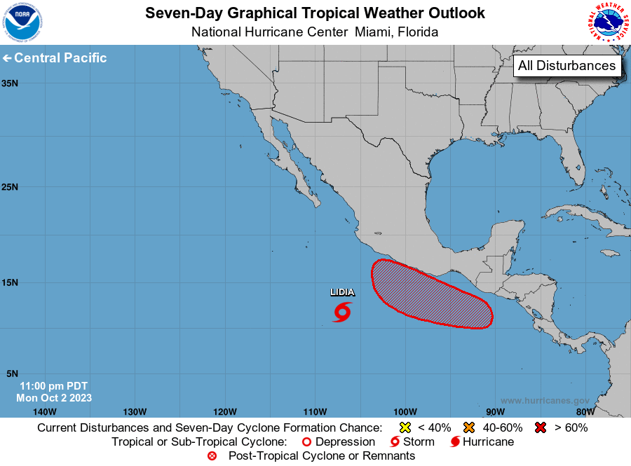
1. South of Southwestern Mexico (EP98):
Showers and thunderstorms appear to be gradually becoming better
organized in association with a broad area of low pressure located
several hundred miles south of the coast of southwestern Mexico.
Environmental conditions are expected to remain favorable for
development, and a tropical depression is expected to form during
the next day or so.  The system is forecast to move generally
northwestward through the end of the week.
* Formation chance through 48 hours...high...90 percent.
* Formation chance through 7 days...high...near 100 percent.

2. South of Central America:
An area of low pressure is expected to form a few hundred miles
south of the coast of Central America during the next few days.
Afterward, environmental conditions are expected to be conducive for
gradual development of this system, and a tropical depression is
likely to form late this week or over the weekend while the system
moves slowly westward or west-northwestward.
* Formation chance through 48 hours...low...near 0 percent.
* Formation chance through 7 days...high...70 percent.

Forecaster Papin





 NHC on Facebook
 Twitter
 YouTube
 NHC Blog: