ZCZC MIATWOAT ALL
TTAA00 KNHC DDHHMM
Tropical Weather Outlook
NWS National Hurricane Center Miami FL
800 AM EDT Mon Oct 24 2022
For the North Atlantic...Caribbean Sea and the Gulf of Mexico:
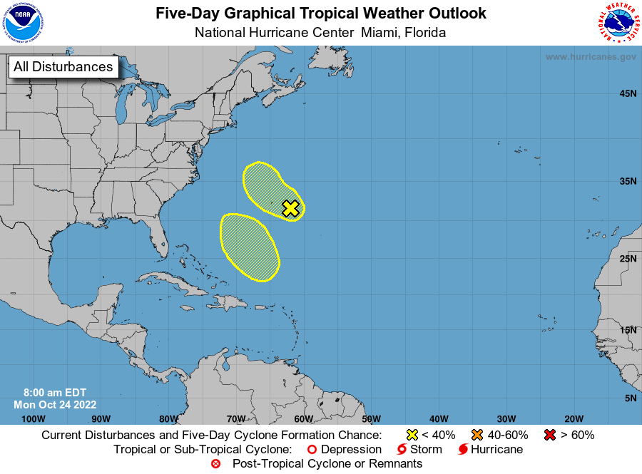
1. Central Subtropical Atlantic:
Showers and thunderstorms have changed little since yesterday
afternoon in association with a trough of low pressure located
around 200 miles east of Bermuda. Environmental conditions are
only marginally conducive for some tropical or subtropical
development of this system over the next day or so while it
generally moves westward, passing near Bermuda later today and
tonight. Afterward, the system is forecast to turn northward
toward cooler waters and less favorable upper-level winds over the
northwestern Atlantic, and further development is not anticipated
by that time.
* Formation chance through 48 hours...low...10 percent.
* Formation chance through 5 days...low...10 percent.
2. Southwestern Atlantic:
An area of low pressure is expected to form north of Puerto
Rico over the southwestern Atlantic in a few days. Thereafter,
environmental conditions appear conducive for some subtropical
development of this system while it meanders over the southwestern
Atlantic through the early part of the weekend.
* Formation chance through 48 hours...low...near 0 percent.
* Formation chance through 5 days...low...20 percent.
Forecaster Roberts