Skip Navigation Links
NOAA NOAA United States Department of Commerce

NHC Graphical Outlook Archive


« Earliest Available         ‹ Earlier         Later ›         Latest Available »
GIS Shapefiles
Central Pacific Eastern Pacific Atlantic

View 2-Day Graphical Tropical Weather Outlook
Click for Atlantic Click for Atlantic

Tropical Weather Outlook Text

ZCZC MIATWOEP ALL
TTAA00 KNHC DDHHMM

Tropical Weather Outlook
NWS National Hurricane Center Miami FL
500 PM PDT Mon Oct 17 2022

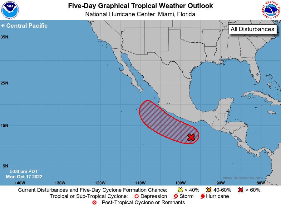
For the eastern North Pacific...east of 140 degrees west longitude:

1. Offshore of Southern Mexico:
A broad trough of low pressure has formed a few hundred miles south 
of the southern coast of Mexico and is producing a large area of 
showers and thunderstorms. Environmental conditions appear conducive 
for additional development, and a tropical depression is likely to 
form late this week while the system moves westward to 
west-northwestward at 10-15 mph.
* Formation chance through 48 hours...low...20 percent.
* Formation chance through 5 days...high...80 percent.

Forecaster Papin


List of Atlantic Outlooks (May 2023 - present)
List of East Pacific Outlooks (May 2023 - present)
List of Central Pacific Outlooks (May 2023 - present)
List of Atlantic Outlooks (July 2014 - April 2023)
List of East Pacific Outlooks (July 2014 - April 2023)
List of Central Pacific Outlooks (June 2019 - April 2023)
List of Atlantic Outlooks (June 2009 - June 2014)
List of East Pacific Outlooks (June 2009 - June 2014)