ZCZC MIATWOAT ALL
TTAA00 KNHC DDHHMM
Tropical Weather Outlook
NWS National Hurricane Center Miami FL
200 PM EDT Tue Oct 11 2022
For the North Atlantic...Caribbean Sea and the Gulf of Mexico:
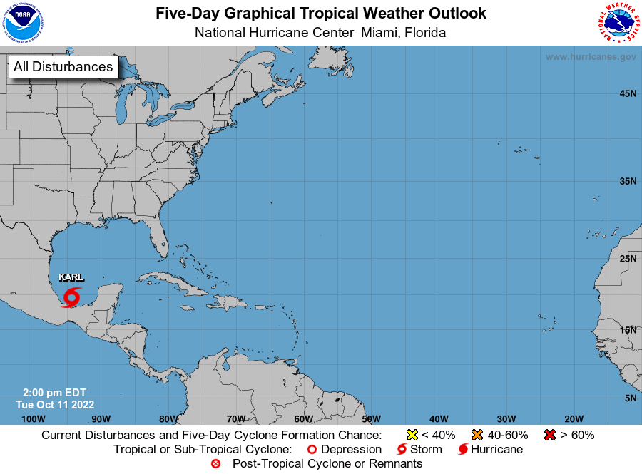
1. Southwest Gulf of Mexico:
Satellite-derived surface winds indicate that the area of low
pressure over the Bay of Campeche is becoming better defined.
Environmental conditions are forecast to be conducive for further
development, and a tropical depression or tropical storm is likely
to form within the next day or so while the system moves slowly
northwestward over the southwestern Gulf of Mexico. Heavy rainfall
is also expected over portions of southern Mexico during the next
couple of days. An Air Force Reserve reconnaissance aircraft is en
route to investigate the system, and interests in southwestern
Mexico should monitor the progress of this disturbance.
* Formation chance through 48 hours...high...80 percent.
* Formation chance through 5 days...high...80 percent.
Forecaster Bucci/Blake