ZCZC MIATWOAT ALL
TTAA00 KNHC DDHHMM
Tropical Weather Outlook
NWS National Hurricane Center Miami FL
200 AM EDT Mon Sep 26 2022
For the North Atlantic...Caribbean Sea and the Gulf of Mexico:
Active Systems:
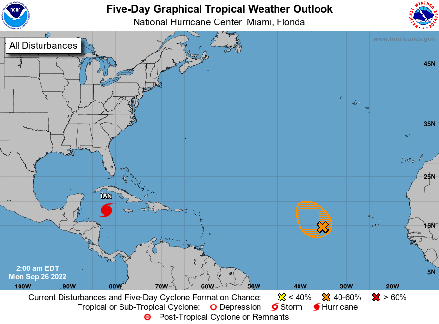
The National Hurricane Center is issuing advisories on Tropical
Storm Ian, located over the western Caribbean Sea, and has
issued the last advisory on Tropical Storm Gaston, located a few
hundred miles west of the western Azores.
1. Central Tropical Atlantic:
An area of low pressure located several hundred miles west of the
Cabo Verde Islands is producing persistent but disorganized
showers and thunderstorms. Environmental conditions appear
conducive for some development, and a tropical depression could
form during the next few days before upper-level winds become less
favorable toward the end of the week. The system is expected to
meander during the next day or two and then move slowly
north-northwestward.
* Formation chance through 48 hours...medium...40 percent.
* Formation chance through 5 days...medium...50 percent.
Forecaster Roberts