ZCZC MIATWOEP ALL
TTAA00 KNHC DDHHMM
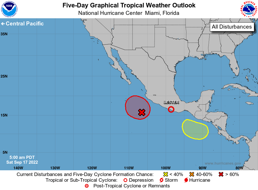
Tropical Weather Outlook
NWS National Hurricane Center Miami FL
500 AM PDT Sat Sep 17 2022
For the eastern North Pacific...east of 140 degrees west longitude:
Active Systems:
The National Hurricane Center is issuing advisories on Tropical
Storm Lester, located just off the coast of southwestern Mexico.
1. Southwest of Southwestern Mexico:
A low pressure system continues to produce shower and thunderstorm
activity a few hundred miles southwest of Manzanillo, Mexico. This
disturbance continues to show signs of organization, and a tropical
depression will likely form later today or tonight. The low is
forecast to meander off the southwestern coast of Mexico this
weekend, and then turn north-northwestward early next week. For more
information on this system, including gale warnings, please see High
Seas Forecasts issued by the National Weather Service.
* Formation chance through 48 hours...high...90 percent.
* Formation chance through 5 days...high...90 percent.
2. South of Central America and Southeastern Mexico:
An area of low pressure could form over the far eastern portion of
the eastern North Pacific basin early next week. Environmental
conditions are forecast to be conducive for some gradual development
while the system moves west-northwestward near or offshore the coast
of southern Mexico through mid-week.
* Formation chance through 48 hours...low...near 0 percent.
* Formation chance through 5 days...low...20 percent.
High Seas Forecasts issued by the National Weather Service
can be found under AWIPS header NFDHSFEPI, WMO header FZPN02
KWBC, and on the web at ocean.weather.gov/shtml/NFDHSFEPI.php
Forecaster D. Zelinsky