ZCZC MIATWOAT ALL
TTAA00 KNHC DDHHMM
Tropical Weather Outlook
NWS National Hurricane Center Miami FL
800 PM EDT Fri Sep 16 2022
For the North Atlantic...Caribbean Sea and the Gulf of Mexico:
Active Systems:
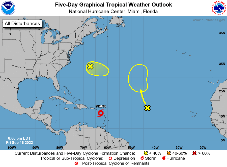
The National Hurricane Center is issuing advisories on Tropical
Storm Fiona, located very near Guadeloupe in the Leeward Islands.
1. Western Atlantic:
A frontal low over the western Atlantic Ocean a couple of hundred
miles northwest of Bermuda continues to produce disorganized
showers and thunderstorms. This low is expected to move eastward
to east-southeastward at 10 to 15 mph, and development into a
tropical cyclone is not anticipated due to strong upper-level winds.
* Formation chance through 48 hours...low...10 percent.
* Formation chance through 5 days...low...10 percent.
2. Central Atlantic:
Showers and thunderstorms remain disorganized in association with
the northern end of a tropical wave over the central Atlantic.
Some slow development of this system is possible early next week
while it moves northwestward to northward.
* Formation chance through 48 hours...low...near 0 percent.
* Formation chance through 5 days...low...20 percent.
Forecaster Cangialosi