ZCZC MIATWOAT ALL
TTAA00 KNHC DDHHMM
Tropical Weather Outlook
NWS National Hurricane Center Miami FL
200 AM EDT Mon Sep 5 2022
For the North Atlantic...Caribbean Sea and the Gulf of Mexico:
Active Systems:
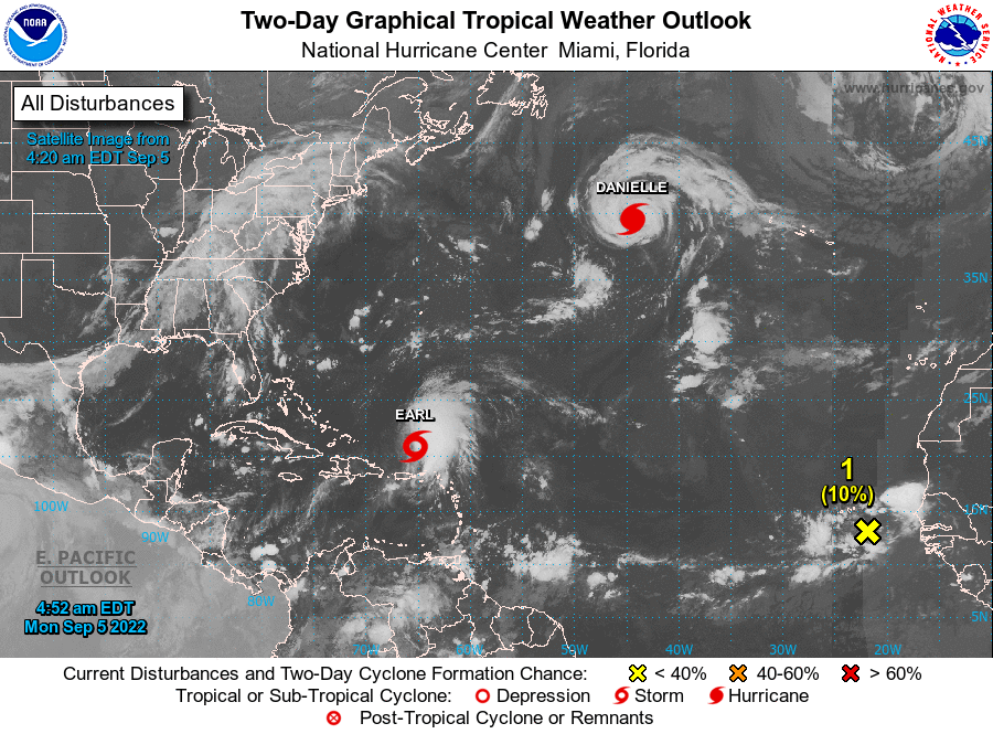
The National Hurricane Center is issuing advisories on Hurricane
Danielle, located about 950 miles west of the Azores, and on
Tropical Storm Earl, located about 125 miles north-northwest of
the Virgin Islands.
1. Eastern Tropical Atlantic:
A tropical wave located southeast of the Cabo Verde Islands is
producing some disorganized shower and thunderstorm activity. An
area of low pressure could form in association with this system
during the next day or two, and subsequent gradual development is
possible as it moves generally west-northwestward over the eastern
and central tropical Atlantic during the next several days.
* Formation chance through 48 hours...low...10 percent.
* Formation chance through 5 days...low...30 percent.
Forecaster Beven