ZCZC MIATWOEP ALL
TTAA00 KNHC DDHHMM
Tropical Weather Outlook
NWS National Hurricane Center Miami FL
500 PM PDT Fri Sep 2 2022
For the eastern North Pacific...east of 140 degrees west longitude:
Active Systems:
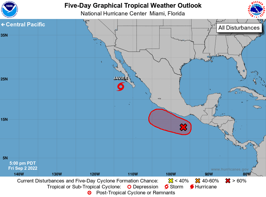
The National Hurricane Center is issuing advisories on Tropical
Storm Javier, located a couple hundred miles west of the southern
tip of the Baja California peninsula.
1. South of Southern Mexico:
Shower and thunderstorm activity associated with a broad area of low
pressure located several hundred miles south of the southern coast
of Mexico is slowly beginning to show signs of organization.
Continued gradual development of this system is expected, and a
tropical depression will likely form this weekend while the system
moves generally west-northwestward or northwestward near the coast
of southern and southwestern Mexico. Regardless of development,
heavy rain is possible along the coasts of southern and southwestern
Mexico through early next week, and interests in those locations
should monitor the progress of this system.
* Formation chance through 48 hours...high...70 percent.
* Formation chance through 5 days...high...90 percent.
Forecaster D. Zelinsky