ZCZC MIATWOAT ALL
TTAA00 KNHC DDHHMM
Tropical Weather Outlook
NWS National Hurricane Center Miami FL
800 AM EDT Fri Aug 26 2022
For the North Atlantic...Caribbean Sea and the Gulf of Mexico:
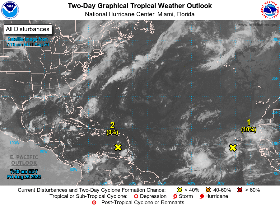
1. Eastern Tropical Atlantic:
A tropical wave located to the west of the Cabo Verde Islands is
producing a large area of disorganized showers and thunderstorms.
Environmental conditions could support some gradual development of
this system through early next week while it moves westward across
the eastern and central tropical Atlantic at 10 to 15 mph.
* Formation chance through 48 hours...low...10 percent.
* Formation chance through 5 days...low...30 percent.
2. Eastern Caribbean Sea:
A trough of low pressure located over the eastern Caribbean Sea is
producing minimal shower and thunderstorm activity. This system is
expected to move westward at about 15 mph during the next several
days, and environmental conditions could become more conducive for
slow development by early next week when it moves across the central
and western Caribbean Sea.
* Formation chance through 48 hours...low...near 0 percent.
* Formation chance through 5 days...low...20 percent.
Forecaster Reinhart