ZCZC HFOTWOCP ALL
TTAA00 PHFO DDHHMM
Tropical Weather Outlook
NWS Central Pacific Hurricane Center Honolulu HI
200 AM HST Sun Aug 7 2022
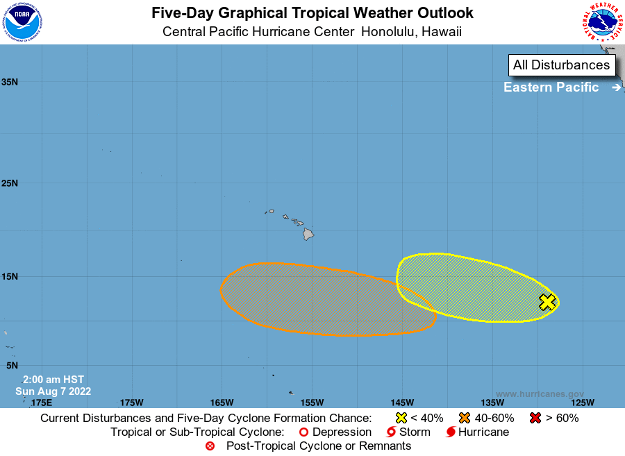
For the central North Pacific...between 140W and 180W:
1. Well Southeast of the Main Hawaiian Islands:
An area of low pressure could form well southeast or south of the
main Hawaiian Islands Monday or Tuesday. Environmental conditions
could allow for some gradual development of this system, and a
tropical depression could form as it moves quickly westward over the
central Pacific during the middle part of next week.
* Formation chance through 48 hours...low...near 0 percent.
* Formation chance through 5 days...medium...40 percent.
2. A large area of disorganized showers and thunderstorms is
associated with a broad trough of low pressure located more than
1000 miles east-southeast of the Hawaiian Islands. Some gradual
development of this system is possible through the middle part of
this week while it moves westward toward the central Pacific basin.
* Formation chance through 48 hours...low...10 percent.
* Formation chance through 5 days...low...20 percent.
Elsewhere, no tropical cyclones are expected during the next 5 days.
Forecaster Almanza