ZCZC MIATWOEP ALL
TTAA00 KNHC DDHHMM
Tropical Weather Outlook
NWS National Hurricane Center Miami FL
1100 AM PDT Thu Aug 4 2022
For the eastern North Pacific...east of 140 degrees west longitude:
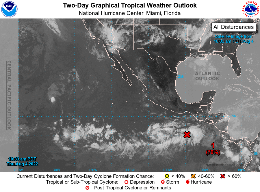
1. Offshore of Southern Mexico:
Shower and thunderstorm activity has increased since yesterday in
association with a broad area of low pressure located offshore of
the coasts of Guatemala and southern Mexico. Environmental
conditions appear conducive for development of this system, and a
tropical depression is likely to form during the next couple of
days. The system is forecast to move generally west-northwestward at
10 to 15 mph over the weekend and into early next week, remaining
well offshore of the coasts of southern and southwestern Mexico.
* Formation chance through 48 hours...high...70 percent.
* Formation chance through 5 days...high...90 percent.
2. Well Southeast of the Main Hawaiian Islands:
Another area of low pressure is forecast to form over the far
western portion of the eastern Pacific basin by this weekend. Some
gradual development of this system is forecast, and a tropical
depression could form early next week while it moves westward toward
and into the central Pacific basin.
* Formation chance through 48 hours...low...near 0 percent.
* Formation chance through 5 days...medium...40 percent.
Forecaster Reinhart