ZCZC MIATWOEP ALL
TTAA00 KNHC DDHHMM
Tropical Weather Outlook
NWS National Hurricane Center Miami FL
500 PM PDT Thu Jul 21 2022
For the eastern North Pacific...east of 140 degrees west longitude:
Active Systems:
The National Hurricane Center has issued the last advisory on
Post-Tropical Cyclone Estelle, located well to the west of
the southern tip of the Baja California peninsula.
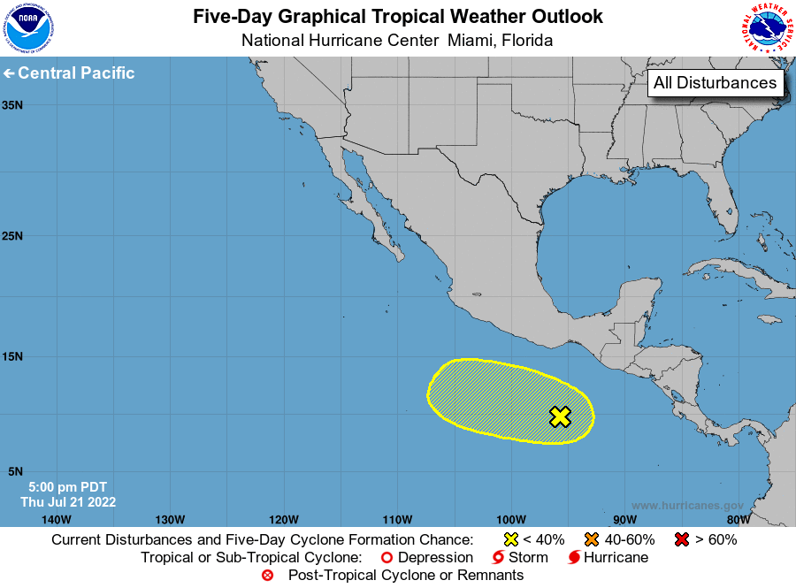
1. Offshore of Southern Mexico:
A large area of disorganized showers and thunderstorms located
several hundred miles offshore of southern Mexico is associated with
an elongated trough of low pressure. Some gradual development of
this system is possible by this weekend or early next week while it
moves slowly westward to west-northwestward at 5 to 10 mph.
* Formation chance through 48 hours...low...10 percent.
* Formation chance through 5 days...low...30 percent.
Forecaster Papin