ZCZC MIATWOEP ALL
TTAA00 KNHC DDHHMM
Tropical Weather Outlook
NWS National Hurricane Center Miami FL
1100 AM PDT Wed Jul 13 2022
For the eastern North Pacific...east of 140 degrees west longitude:
Active Systems:
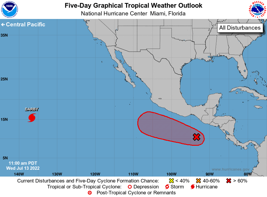
The National Hurricane Center is issuing advisories on Hurricane
Darby, located about 1800 miles west-southwest of the southern
tip of the Baja California peninsula.
1. Offshore of Southern Mexico:
A broad area of low pressure is located a few hundred miles south of
the Gulf of Tehuantepec. Shower and thunderstorm activity associated
with the disturbance is beginning to show signs of organization.
Environmental conditions appear conducive for additional
development, and a tropical depression is expected to form well
offshore of the coast of southern Mexico by Friday or Saturday. The
disturbance is forecast to drift westward for the next day or two,
then move west-northwestward at 10 to 15 mph through the weekend
while remaining offshore of the southern and southwestern coasts of
Mexico.
* Formation chance through 48 hours...medium...40 percent.
* Formation chance through 5 days...high...90 percent.
Forecaster D. Zelinsky/R. Zelinsky