ZCZC MIATWOEP ALL
TTAA00 KNHC DDHHMM
Tropical Weather Outlook
NWS National Hurricane Center Miami FL
500 PM PDT Wed Jul 6 2022
For the eastern North Pacific...east of 140 degrees west longitude:
Active Systems:
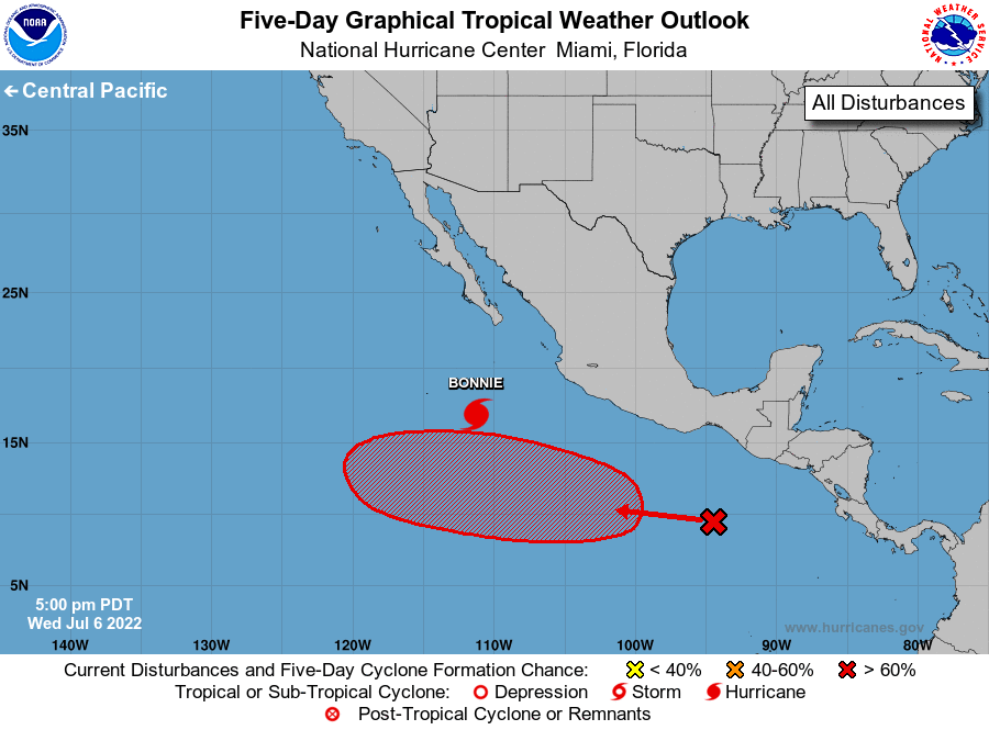
The National Hurricane Center is issuing advisories on Hurricane
Bonnie, located several hundred miles south of the southern tip of
the Baja California peninsula.
1. Offshore of Southeastern Mexico:
A tropical wave located several hundred miles south of the
southeastern coast of Mexico is producing an area of disorganized
showers and thunderstorms. Environmental conditions are expected
to be conducive for gradual development, and a tropical depression
is likely to form well south or southwest of the southwestern coast
of Mexico over the weekend while the disturbance moves generally
west-northwestward at 10 to 15 mph.
* Formation chance through 48 hours...low...20 percent.
* Formation chance through 5 days...high...70 percent.
Forecaster Pasch/Bucci