ZCZC MIATWOAT ALL
TTAA00 KNHC DDHHMM
Tropical Weather Outlook
NWS National Hurricane Center Miami FL
200 AM EDT Thu Jun 30 2022
For the North Atlantic...Caribbean Sea and the Gulf of Mexico:
Active Systems:
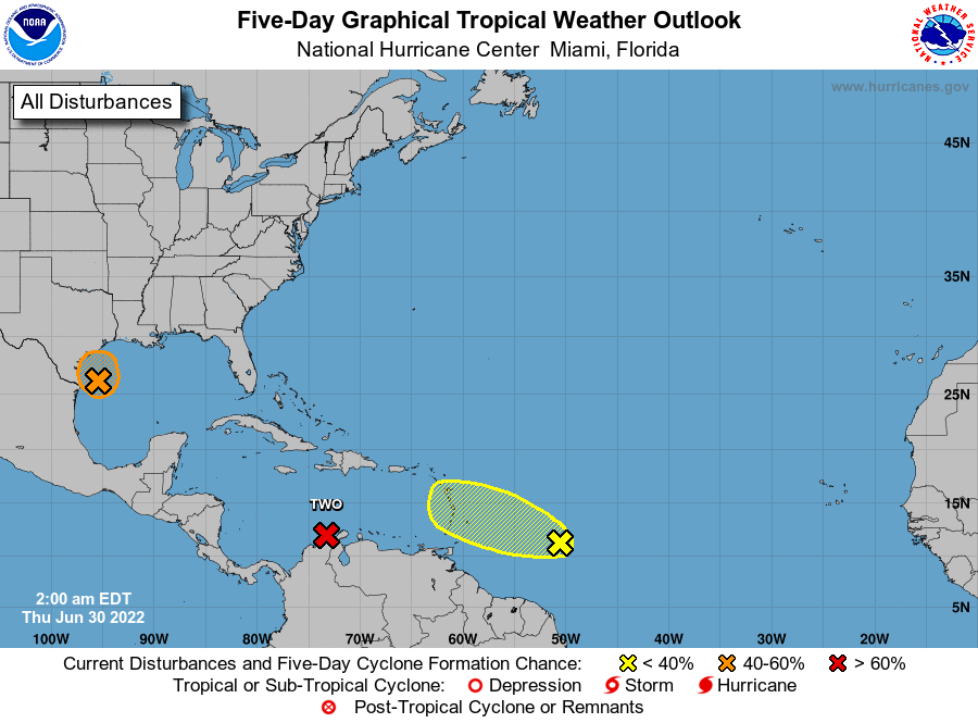
The National Hurricane Center is issuing advisories on Potential
Tropical Cyclone Two, located over the Guajira Peninsula.
* Formation chance through 48 hours...high...90 percent.
* Formation chance through 5 days...high...90 percent.
1. Western Gulf of Mexico:
Shower and thunderstorm activity remains poorly organized with an
area of low pressure located over the western Gulf of Mexico. This
system is forecast to move slowly westward and approach the coast of
southern Texas and northern Mexico later today. Some slow
development is still possible, and it could still become a
short-lived tropical depression near the coast before it turns
northwestward and moves inland over Texas later today. Regardless of
development, heavy rain will be possible along portions of the Texas
coast for the next few days. For more information about the
potential for heavy rain, please see products issued by your
National Weather Service office.
* Formation chance through 48 hours...medium...40 percent.
* Formation chance through 5 days...medium...40 percent.
2. Western Tropical Atlantic:
A tropical wave located over the western tropical Atlantic continues
to produce disorganized showers and thunderstorms. Only slight
additional development of this system is anticipated while it moves
west-northwestward for the next several days. The wave is forecast
to move over the Windward Islands late Friday or early Saturday and
then over the eastern Caribbean Sea by the weekend, where further
development is unlikely due to unfavorable environmental conditions.
* Formation chance through 48 hours...low...10 percent.
* Formation chance through 5 days...low...10 percent.
Forecaster Papin