ZCZC MIATWOEP ALL
TTAA00 KNHC DDHHMM
Tropical Weather Outlook
NWS National Hurricane Center Miami FL
1100 PM PDT Wed Jun 29 2022
For the eastern North Pacific...east of 140 degrees west longitude:
Active Systems:
The National Hurricane Center is issuing advisories on Atlantic
basin Potential Tropical Cyclone Two, currently located over the
Guajira Peninsula. The system is forecast to cross Central America
and move into the east Pacific basin, as a tropical cyclone, over
the weekend.
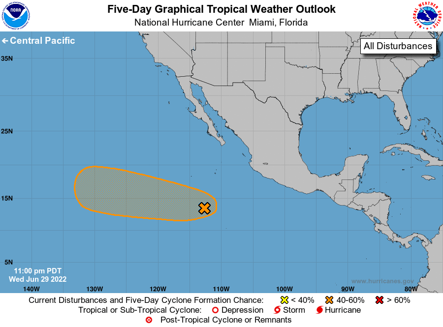
1. Offshore of Southern Mexico:
Scattered showers and thunderstorms located several hundred miles
southwest of the coast of southwestern Mexico are associated with an
area of low pressure. While this system still lacks a well-defined
circulation, environmental conditions remain generally conducive for
development, and a tropical depression could still form over the
next couple of days. This system is moving towards the
west-northwest at 10 to 15 mph and will be moving towards cooler
waters by early next week, where additional development is unlikely
after that time.
* Formation chance through 48 hours...medium...60 percent.
* Formation chance through 5 days...medium...60 percent.
Forecaster Papin