ZCZC MIATWOEP ALL
TTAA00 KNHC DDHHMM
Tropical Weather Outlook
NWS National Hurricane Center Miami FL
1100 PM PDT Tue Jun 28 2022
For the eastern North Pacific...east of 140 degrees west longitude:
Active Systems:
The National Hurricane Center is issuing advisories on Atlantic
basin Potential Tropical Cyclone Two, currently located in the
eastern Caribbean Sea to the north of Venezuela. The system is
forecast to cross Central America and move into the east Pacific
basin, as a tropical cyclone, over the weekend.
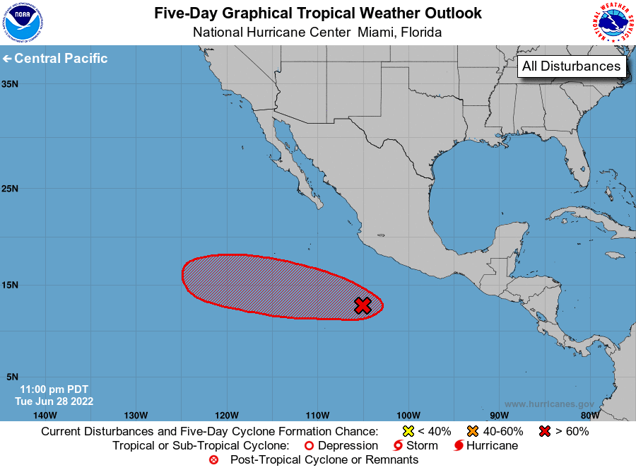
1. Offshore of Southern Mexico:
Showers and thunderstorms associated with a small low pressure
system centered a few hundred miles south of the coast of
southwestern Mexico continue to show signs of organization. However,
recently received satellite wind data suggests the circulation is
somewhat less defined than earlier today. Environmental conditions
still appear favorable for additional development over the next
couple of days, and a tropical depression is likely to form while
the system moves west-northwestward at 10 to 15 mph through the end
of the week.
* Formation chance through 48 hours...high...70 percent.
* Formation chance through 5 days...high...70 percent.
Forecaster Papin