ZCZC MIATWOAT ALL
TTAA00 KNHC DDHHMM
Tropical Weather Outlook
NWS National Hurricane Center Miami FL
800 PM EDT Thu Jun 16 2022
For the North Atlantic...Caribbean Sea and the Gulf of Mexico:
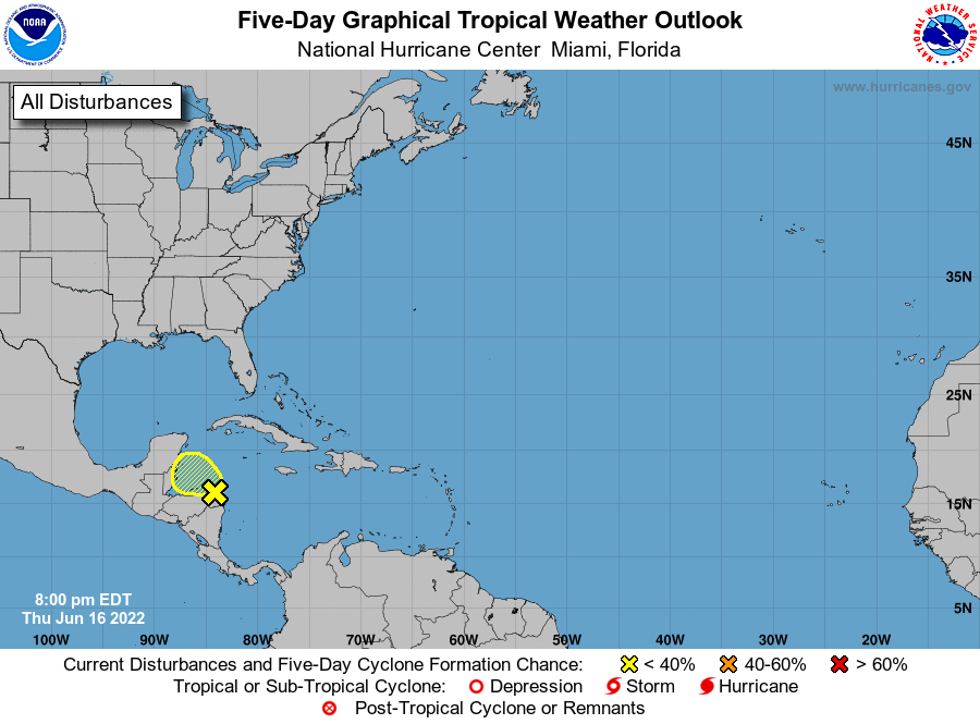
1. Southwestern Caribbean Sea:
Disorganized showers and thunderstorms over the western Caribbean
Sea are associated with a trough of low pressure located near
eastern Honduras. Some slight development is possible tonight
through Friday while the disturbance moves west-northwestward over
the Gulf of Honduras. Subsequent development is unlikely once the
system moves inland over northern Central America and southeastern
Mexico Friday night. Regardless of development, locally heavy
rainfall is possible over Honduras, Belize and southeastern Mexico
through the weekend.
* Formation chance through 48 hours...low...10 percent.
* Formation chance through 5 days...low...10 percent.
Forecaster Pasch/Bucci