ZCZC MIATWOEP ALL
TTAA00 KNHC DDHHMM
Tropical Weather Outlook
NWS National Hurricane Center Miami FL
500 AM PDT Thu Jun 16 2022
For the eastern North Pacific...east of 140 degrees west longitude:
Active Systems:
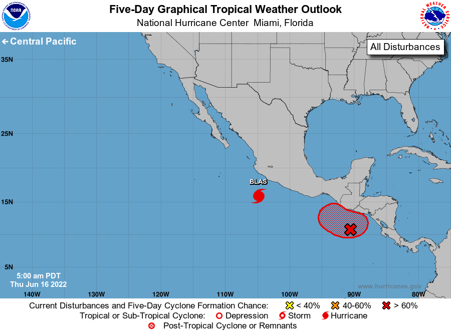
The National Hurricane Center is issuing advisories on Hurricane
Blas, located a few hundred miles southwest of the southwest coast
of Mexico.
1. Off the coast of Central America:
Shower and thunderstorm activity has increased some with an area of
low pressure located a couple of hundred miles south of the coasts
of Guatemala and El Salvador. Environmental conditions are forecast
to become a bit more favorable over the next day or two and a
tropical depression is likely to form over the next couple of days.
This system is forecast to drift erratically through the weekend but
begin a more pronounced westward motion by early next week.
Regardless of development, locally heavy rains are possible across
portions of El Salvador, Guatemala, and southeastern Mexico during
the next several days.
* Formation chance through 48 hours...high...80 percent.
* Formation chance through 5 days...high...80 percent.
Forecaster Papin