ZCZC MIATWOEP ALL
TTAA00 KNHC DDHHMM
Tropical Weather Outlook
NWS National Hurricane Center Miami FL
500 AM PDT Wed Jun 15 2022
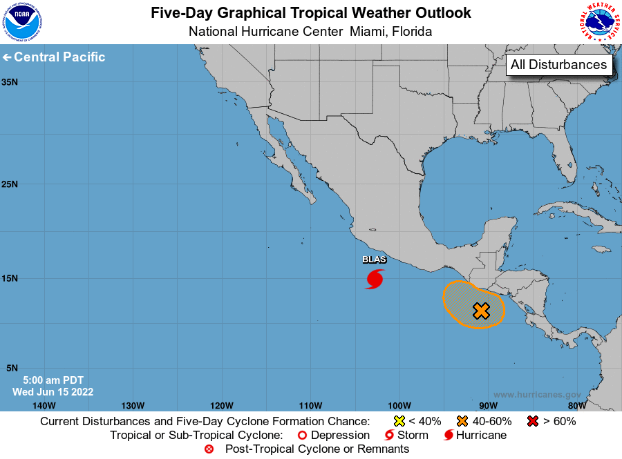
For the eastern North Pacific...east of 140 degrees west longitude:
The National Hurricane Center is issuing advisories on Tropical
Storm Blas, located a few hundred miles south of the southwest coast
of Mexico.
1. Off the coast of Central America:
A large area of showers and thunderstorms off the coast of Guatemala
and El Salvador are associated with a trough of low pressure.
Gradual development of this system is possible while it drifts
erratically, and it could become a tropical depression during the
next couple of days. Environmental conditions are forecast to
become less conducive for development by this weekend. Regardless of
development, locally heavy rains are possible across portions of El
Salvador, Guatemala, and southeastern Mexico during the next several
days.
* Formation chance through 48 hours...medium...60 percent.
* Formation chance through 5 days...medium...60 percent.
Forecaster Brown