ZCZC MIATWOAT ALL
TTAA00 KNHC DDHHMM
Tropical Weather Outlook
NWS National Hurricane Center Miami FL
800 PM EDT Fri Jun 3 2022
For the North Atlantic...Caribbean Sea and the Gulf of Mexico:
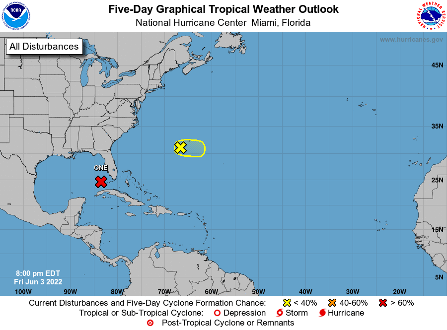
Southeastern Gulf of Mexico:
The National Hurricane Center is issuing advisories on Potential
Tropical Cyclone One, located over the southeastern Gulf of Mexico.
The disturbance is expected to become a tropical storm tonight or
early Saturday.
* Formation chance through 48 hours...high...90 percent.
* Formation chance through 5 days...high...90 percent.
1. In the Western Atlantic west-southwest of Bermuda:
Shower and thunderstorm activity has decreased this evening in
association with the small but well-defined area of low pressure
about 150 miles southwest of Bermuda. This system still has
a brief window for further development through tonight before strong
upper-level winds result in increasingly unfavorable conditions over
the weekend. This system is expected to move generally eastward,
passing south of Bermuda this weekend.
* Formation chance through 48 hours...low...10 percent.
* Formation chance through 5 days...low...10 percent.
Forecaster Latto