ZCZC MIATWOEP ALL
TTAA00 KNHC DDHHMM
Tropical Weather Outlook
NWS National Hurricane Center Miami FL
1100 AM PDT Fri May 27 2022
For the eastern North Pacific...east of 140 degrees west longitude:
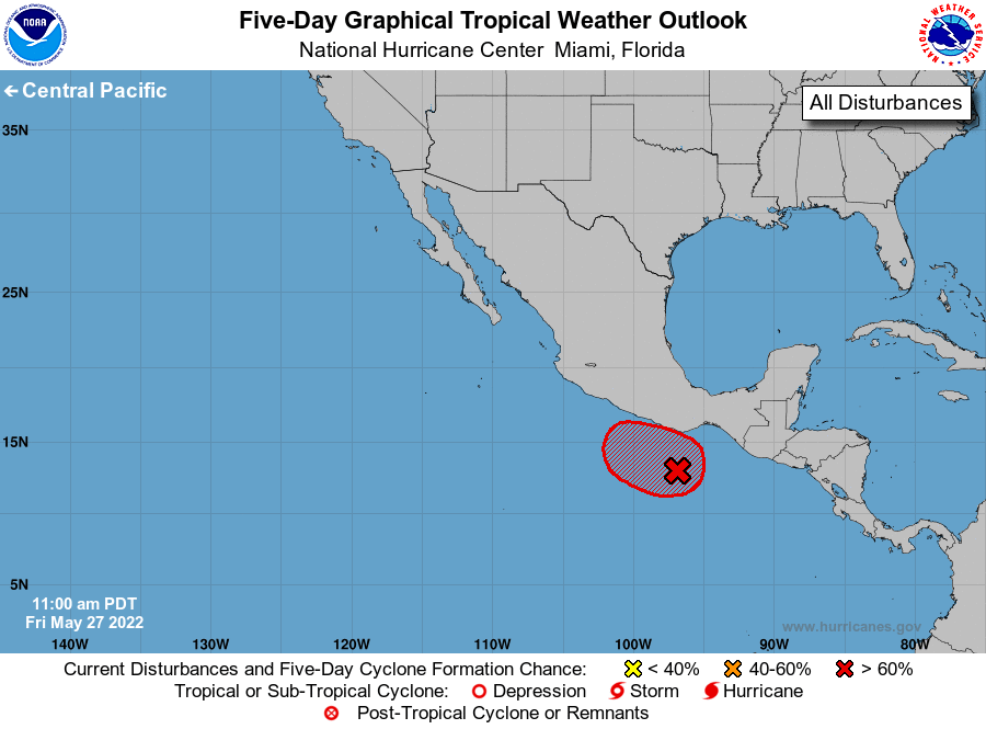
1. South of the Gulf of Tehuantepec:
Showers and thunderstorms associated with an area of low pressure
located about 250 miles south-southwest of the Gulf of Tehuantepec
continue to show signs of organization. Environmental conditions
are conducive for additional development, and a tropical depression
is expected to form later today or Saturday while it moves westward
at 5 to 10 mph. This system is expected to turn northward and
strengthen while it moves toward southern Mexico over the weekend.
Tropical-storm-force or hurricane-force winds are becoming
increasingly likely along the coast of southern Mexico early next
week, and interests there should monitor the progress of this
disturbance. Regardless of development, locally heavy rainfall,
which could cause flash flooding, is possible along coastal sections
of Guatemala and southern Mexico during the next few days.
* Formation chance through 48 hours...high...90 percent.
* Formation chance through 5 days...high...90 percent.
Forecaster Cangialosi/Bucci/Berg