ZCZC MIATWOEP ALL
TTAA00 KNHC DDHHMM
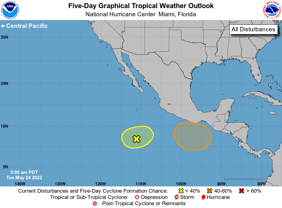
Tropical Weather Outlook
NWS National Hurricane Center Miami FL
500 AM PDT Tue May 24 2022
For the eastern North Pacific...east of 140 degrees west longitude:
1. Central portion of the eastern Pacific:
Disorganized showers and thunderstorms located several hundred miles
off the coast of southwestern Mexico are associated with a trough
of low pressure. Environmental conditions could support some slow
development during the next couple of days while this system
moves little. Upper-level winds are forecast to become too strong
for development late this week.
* Formation chance through 48 hours...low...20 percent.
* Formation chance through 5 days...low...20 percent.
2. South of the Gulf of Tehuantepec:
A broad area of low pressure is forecast to form in a couple of
days a few hundred miles south or southwest of the Gulf of
Tehuantepec. Further development is possible thereafter, and a
tropical depression could form late this week or this weekend while
the system moves west-northwestward or northwestward at 5 to 10 mph.
* Formation chance through 48 hours...low...near 0 percent.
* Formation chance through 5 days...medium...60 percent.
Forecaster Blake