ZCZC MIATWOEP ALL
TTAA00 KNHC DDHHMM
Special Tropical Weather Outlook
NWS National Hurricane Center Miami FL
920 AM PST Thu Jan 20 2022
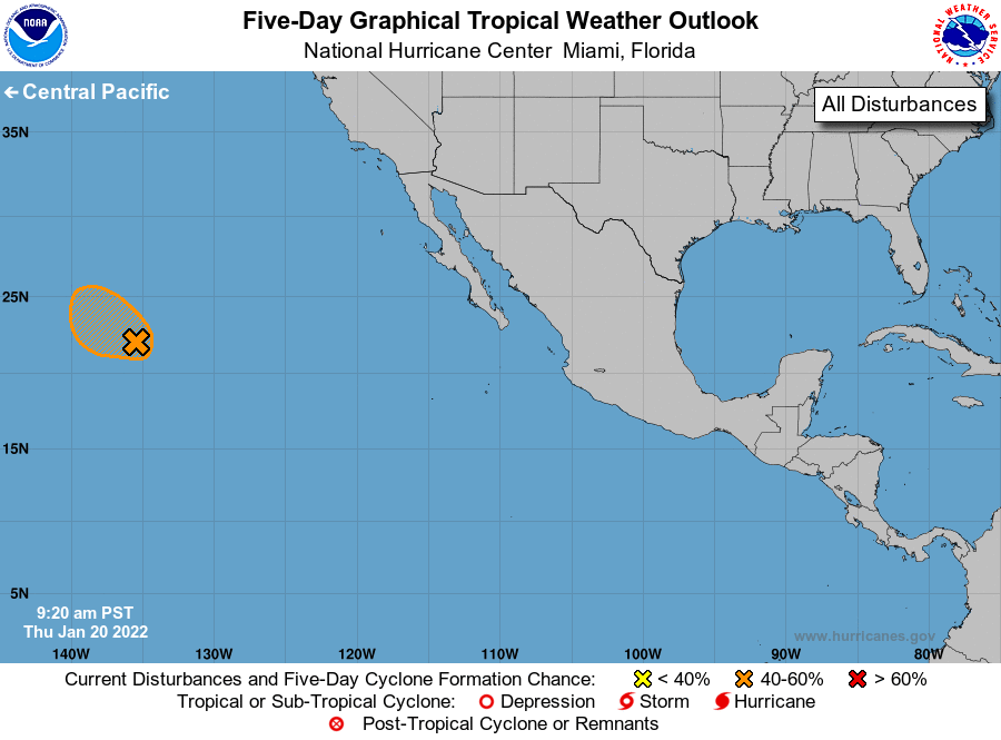
For the eastern North Pacific...east of 140 degrees west longitude:
Special Tropical Weather Outlook issued for an area of low pressure
located well to the east-northeast of Hawaii.
1. A well-defined area of low pressure producing gale-force winds is
located more than 1000 miles east-northeast of Hilo, Hawaii. Shower
and thunderstorm activity has recently increased in coverage and
organization near the center. While environmental conditions appear
only marginally favorable for additional development, if this
activity persists, it could result in the formation of a short-lived
subtropical or tropical cyclone over the next day or so. By Friday,
environmental conditions are expected to become unfavorable for
additional development. For more information on this system,
including gale warnings, see High Seas Forecasts issued by the
National Weather Service.
* Formation chance through 48 hours...medium...40 percent.
* Formation change through 5 days...medium...40 percent.
The next Special Tropical Weather Outlook on this system will be
issued by 7 PM PST this evening, or earlier if conditions warrant.
Forecaster Papin/Cangialosi