ZCZC MIATWOAT ALL
TTAA00 KNHC DDHHMM
Tropical Weather Outlook
NWS National Hurricane Center Miami FL
100 AM EST Wed Nov 10 2021
For the North Atlantic...Caribbean Sea and the Gulf of Mexico:
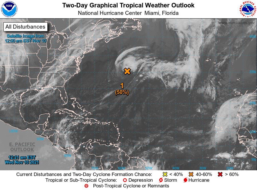
1. Showers and thunderstorms associated with a powerful non-tropical
low pressure system located more than 400 miles northeast of Bermuda
have changed little in organization during the past several hours.
Recent satellite-derived wind data indicate that hurricane-force
winds are occurring south of the center. However, the low is still
interacting with a frontal boundary, and the system has not yet
acquired enough tropical cyclone characteristics to be considered a
subtropical storm. Additional development is still possible during
the next day or two, and a subtropical storm could form during this
time. Thereafter, the system is forecast to move over colder water
and be absorbed by a larger non-tropical low. Additional information
on this system can be found in High Seas forecasts issued by the
National Weather Service.
* Formation chance through 48 hours...medium...50 percent.
* Formation chance through 5 days...medium...50 percent.
High Seas Forecasts issued by the National Weather Service can be
found under AWIPS header NFDHSFAT1, WMO header FZNT01 KWBC, and
online at ocean.weather.gov/shtml/NFDHSFAT1.php
Forecaster Stewart