ZCZC MIATWOAT ALL
TTAA00 KNHC DDHHMM
Tropical Weather Outlook
NWS National Hurricane Center Miami FL
700 PM EST Sun Nov 7 2021
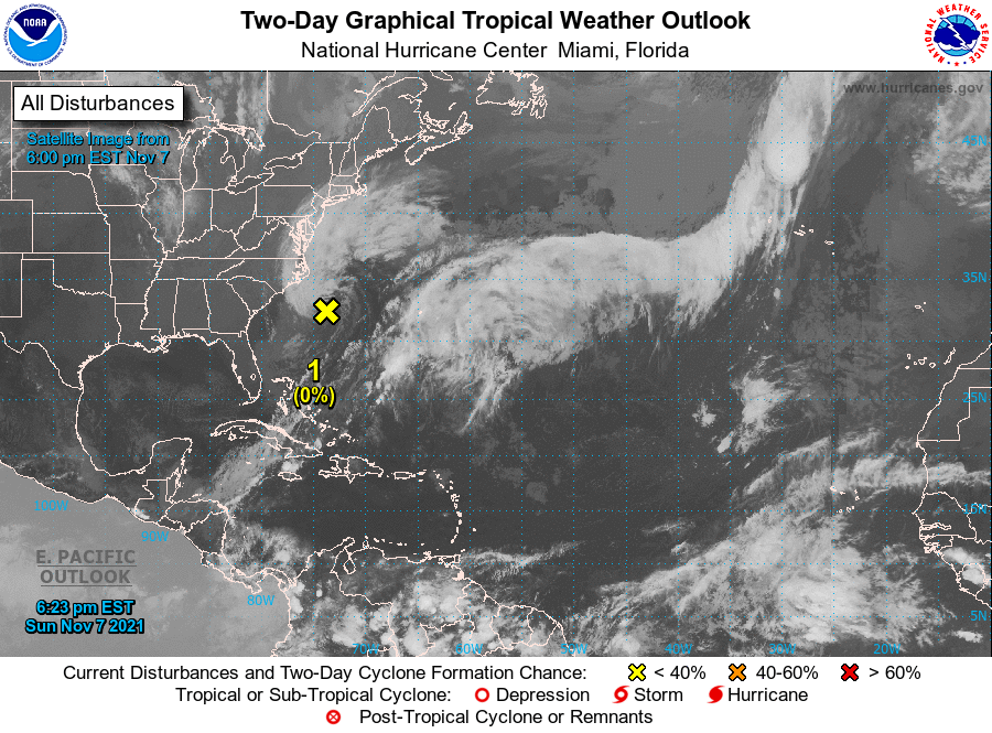
For the North Atlantic...Caribbean Sea and the Gulf of Mexico:
1. A non-tropical low pressure system with storm-force winds is located
a couple of hundred miles south-southeast of Cape Hatteras, North
Carolina. This system is forecast to move east-northeastward during
the next several days, and it could gradually lose its frontal
characteristics by the middle of this week over the subtropical
Atlantic Ocean. Thereafter, the low could acquire some subtropical
characteristics while it moves eastward or east-northeastward over
the open waters of the central Atlantic Ocean. For more information
on this system, including storm and coastal flood warnings, see
products issued by your local National Weather Service office and
High Seas Forecasts issued by the National Weather Service.
* Formation chance through 48 hours...low...near 0 percent.
* Formation chance through 5 days...low...20 percent.
High Seas Forecasts issued by the National Weather Service
can be found under AWIPS header NFDHSFAT1, WMO header FZNT01
KWBC, and online at ocean.weather.gov/shtml/NFDHSFAT1.php
Forecaster Reinhart