ZCZC MIATWOAT ALL
TTAA00 KNHC DDHHMM
Tropical Weather Outlook
NWS National Hurricane Center Miami FL
800 AM EDT Wed Oct 13 2021
For the North Atlantic...Caribbean Sea and the Gulf of Mexico:
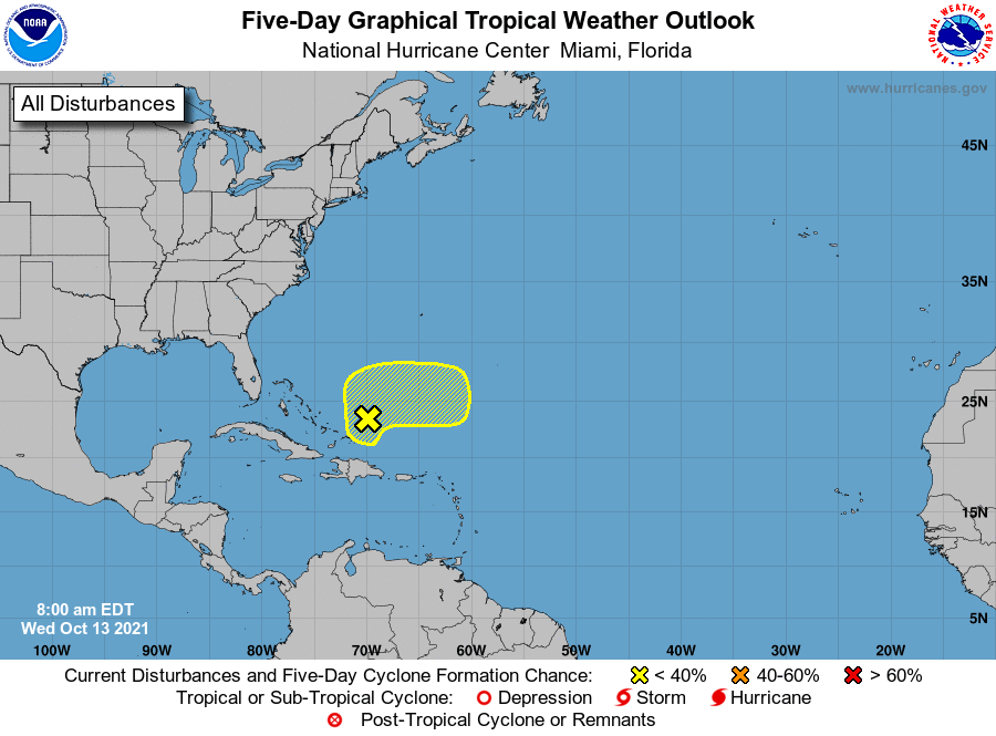
1. A large area of disorganized showers and thunderstorms over
Hispaniola, the Turks and Caicos, the southeastern Bahamas, and
adjacent Atlantic waters continue in association with a surface
trough of low pressure. Development, if any, of this disturbance
should be slow to occur during the next couple of days due to
unfavorable upper-level winds. The system is forecast to drift
northward through tonight, then accelerate eastward as a broad area
of low pressure on Thursday. Toward the end of the week, further
development is not anticipated since the disturbance will be
interacting with a frontal system. Regardless, locally heavy
rainfall is possible over portions of Hispaniola, the Turks and
Caicos, and the southeastern Bahamas during the next day or two.
* Formation chance through 48 hours...low...10 percent.
* Formation chance through 5 days...low...10 percent.
Forecaster Stewart