ZCZC MIATWOAT ALL
TTAA00 KNHC DDHHMM
Tropical Weather Outlook
NWS National Hurricane Center Miami FL
200 PM EDT Tue Oct 12 2021
For the North Atlantic...Caribbean Sea and the Gulf of Mexico:
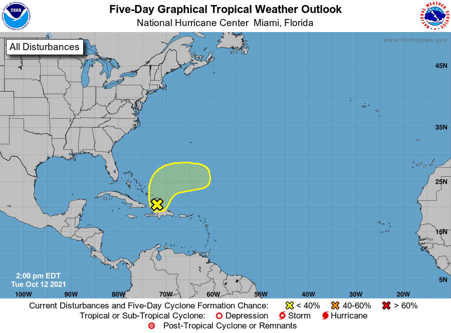
1. Disorganized showers and thunderstorms affecting Hispaniola, the
Turks and Caicos, and the southeastern Bahamas are associated with a
surface trough of low pressure. Development of this system, if any,
should be slow to occur during the next couple of days due to
unfavorable environmental conditions while the disturbance initially
drifts northward and then accelerates eastward on Thursday. The
disturbance is expected to interact with a frontal system by the end
of the week, and further development is unlikely after that time.
Regardless of development, locally heavy rainfall is possible over
portions of Hispaniola, the Turks and Caicos, and the southeastern
Bahamas during the next day or two.
* Formation chance through 48 hours...low...10 percent.
* Formation chance through 5 days...low...10 percent.
Forecaster D. Zelinsky