ZCZC MIATWOAT ALL
TTAA00 KNHC DDHHMM
Tropical Weather Outlook
NWS National Hurricane Center Miami FL
800 AM EDT Tue Oct 12 2021
For the North Atlantic...Caribbean Sea and the Gulf of Mexico:
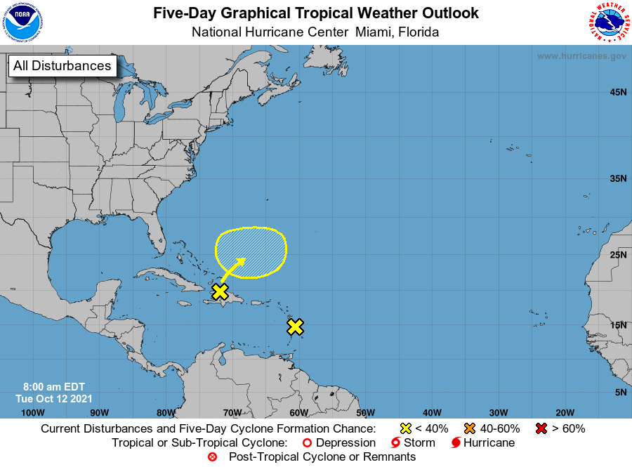
1. A tropical wave located near the Windward Islands has continued to
become less organized this morning and development of the system is
not expected. Locally heavy rainfall and gusty winds will be
possible across portions of the central and northern Lesser
Antilles today.
* Formation chance through 48 hours...low...near 0 percent.
* Formation chance through 5 days...low...near 0 percent.
2. The northern portion of a tropical wave is producing a large area
of disorganized showers and thunderstorms across Hispaniola, the
Turks and Caicos, and the southeastern Bahamas. Development of this
system, if any, will be slow to occur during the next couple of days
due to unfavorable environmental conditions. The system is expected
to interact with a front by the end of the week and further
development is unlikely after that time. Regardless of development,
locally heavy rainfall is possible over portions of Hispaniola, the
Turks and Caicos, and the southeastern Bahamas during the next day
or two.
* Formation chance through 48 hours...low...10 percent.
* Formation chance through 5 days...low...10 percent.
Forecaster D. Zelinsky