ZCZC MIATWOAT ALL
TTAA00 KNHC DDHHMM
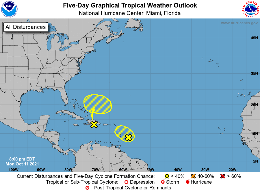
Tropical Weather Outlook
NWS National Hurricane Center Miami FL
800 PM EDT Mon Oct 11 2021
For the North Atlantic...Caribbean Sea and the Gulf of Mexico:
1. A tropical wave associated with a weak area of low pressure is
located less than 200 miles east of the Windward Islands. While this
system continues to produce showers and thunderstorms primarily east
of its center, strong upper-level winds will likely prohibit further
development on Tuesday. Regardless of development, the system could
produce locally heavy rainfall and gusty winds across portions of
the central and northern Lesser Antilles on Tuesday.
* Formation chance through 48 hours...low...10 percent.
* Formation chance through 5 days...low...10 percent.
2. Another tropical wave moving over Hispaniola is producing a large
area of disorganized showers and thunderstorms. While environmental
conditions are not expected to support development of this system
over the next day or two, some gradual development is possible
starting on Wednesday when the system nears the southeastern Bahamas
and begins moving slowly eastward. Regardless of development,
locally heavy rainfall is possible over portions of the Lesser
Antilles, Puerto Rico, and Hispaniola during the next couple of
days.
* Formation chance through 48 hours...low...near 0 percent.
* Formation chance through 5 days...low...20 percent.
Forecaster Papin