ZCZC MIATWOAT ALL
TTAA00 KNHC DDHHMM
Tropical Weather Outlook
NWS National Hurricane Center Miami FL
200 PM EDT Fri Oct 8 2021
For the North Atlantic...Caribbean Sea and the Gulf of Mexico:
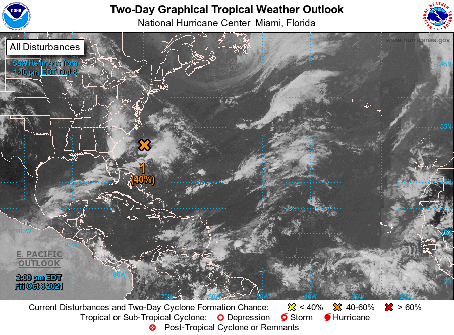
1. Satellite images and surface observations indicate that the low
pressure system located a couple of hundred miles east of the coast
of South Carolina is gradually becoming better defined. Although
the associated shower and thunderstorm activity is currently
disorganized, environmental conditions could briefly become
marginally conducive for the low to acquire subtropical
characteristics by Saturday night and early Sunday. By early next
week, the low is expected to interact with a frontal boundary,
which should end the opportunity for any subtropical or tropical
formation. The low is forecast to meander offshore the Carolinas
today, and then slowly move back toward the west-northwest and
northwest on Saturday, bringing the system closer to the coast of
North Carolina. Interests along the coast of North and South
Carolina should monitor the progress of this system. Regardless of
development, intermittent periods of locally heavy rains and gusty
winds will affect eastern portions of the Carolinas through the
weekend. An Air Force Reserve reconnaissance aircraft is scheduled
to investigate the system Saturday afternoon, if necessary.
* Formation chance through 48 hours...medium...40 percent.
* Formation chance through 5 days...medium...40 percent.
Forecaster Stewart